|
||

|

|
|

|
Stock# m0682
Description
Detailed map of Chicago, hand colored by wards.
Shows streets, roads, rail lines, buildings, parks, light house and other interesting features. One of the best commercial atlas maps of the era. From one of the leading American map publisher of the 1870s.
O.W. Gray Biography
O. W. Gray was a publishing firm based in Philadelphia. Later, they published as O. W. Gray & Son. They published atlases in the late nineteenth century. Gray's National Atlas was one of the most successful commercial ventures of the 1870s and one of the last to employ hand coloring on maps.
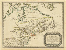
![[French & Indian War] Carte Des Possessions Francoises et Angloises dans le Canada et Partie de la Louisiane . . . 1756](https://storage.googleapis.com/raremaps/img/small/94026.jpg)