|
||

|

|
|

|
Stock# 96483
Description
Interesting map of the area northwest of Old Town, as partitioned in Steele v. Steele in 1891.
The map covers a number of the original pueblo lots immediately southwest and northwest of "Old Town," as shown on the 1870 James Pascoe Map of the Pueblo Lands of San Diego and the original 1869 hand drawn Pascoe map of the Pueblo Lands of San Diego, which pre-dates the inclusion of lot numbers for the Old Town lots.
The map extends north to Pueblo Lots 263, 270, 286 and 297 (Morena / University of San Diego on the north side of Mission Valley, west to Pueblo Lot 259 (San Diego Sports Area area) and south to Pueblo Lots 317 and 332 (Midway District).
Condition Description
Pen & Ink on drafting linen. Minor soiling.
![(Southern California Photographs) [Western Travel Photo Album with Original Photographs of La Jolla, Los Angeles, Ocean Park (Santa Monica), Venice, Mt. Lowe, California; also photos of Trinidad, Colorado, Arizona, Nova Scotia, and other locations; and a number of Southern California printed picture postcards]](https://storage.googleapis.com/raremaps/img/small/90545.jpg)
![[ San Diego River Estuary ] Partition of Pueblo Lot No. 275 of San Diego California. Made under decree of Superior Court dated Feb. 20th 1820](https://storage.googleapis.com/raremaps/img/small/96546.jpg)
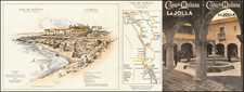
![[ La Jolla ] La Jolla Street Map](https://storage.googleapis.com/raremaps/img/small/100138.jpg)