


|
||

|

|
|

|
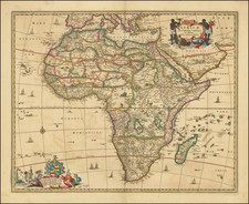
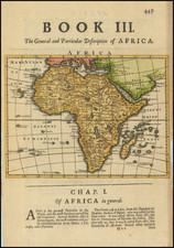
Large and highly detailed original antique map of the African continent, published in Germany at the peak of European colonialization.
The map shows the African continent in great detail, with several insets throughout. Rivers, cities, early railroads, shipping lines, and much more are all indicated. The map is colored according to the ruling colonial power of each region, with pink representing the British, Purple the French, yellow the Portuguese, green the Spanish, and orange the Dutch.
Insets on the map include the "Gold and Slave Coast", "Capland" (South Africa), Senegambia, the lower Congo, Zanzibar, Cape Town, Abyssina, Cairo, Alexandria, the Lower Nile, Suez Canal and West Cameron. The map is accompanied by a thorough and detailed index entitled "Karte von Afrika mit Namenverzeichnis aus Stielers Hand-Atlas."
This map was published in Gotha by Justus Perthes.
The map includes an impressive treatment of the Arabian Peninsula, as well.
![[Africa] (2 maps - Ancient & Modern)](https://storage.googleapis.com/raremaps/img/small/70579.jpg)