|
||

|

|
|

|
Titled United States West Coast California Santa Monica Bay, this nautical chart was produced by the United States Department of Commerce and the Coast and Geodetic Survey. Published on February 16, 1948, with revisions made on March 26, 1962, the map offers an insight into mid-20th-century marine navigation, focusing on the Santa Monica Bay area.
Rooted in the early years of post-World War II, the initial issue of this chart draws on hydrographic and topographic data gathered by the Coast and Geodetic Survey, with additions and revisions by the Geological Survey. This dual contribution of scientific agencies signals an era of intense cooperation and innovation, as the United States sought to improve navigation safety and economic activities on its coastlines. By 1962, the era of this chart's revision, such endeavors were increasingly important in the context of the burgeoning Cold War and the growing significance of marine and aeronautical technologies.
The map presents a detailed view of Santa Monica Bay, employing a myriad of abbreviations and symbols to indicate various geographic and hydrographic features. It is a testament to the advanced navigation technology of the time, including references to a range of elements such as lights, buoys, day beacons, and even the geological composition of the Bay's seabed. Notably, the chart also includes a section on storm warnings, reflecting the close connection between nautical navigation and meteorological information, as well as the emerging infrastructure to relay such data.
One particular feature that sets this chart apart is its attention to the precise locations of U.S. Weather Bureau storm warning displays, specifically mentioning Santa Monica Pier and Redondo Beach. This specificity underlines the seriousness with which such warnings were taken in the mid-20th century, a period that saw significant developments in weather prediction and the understanding of its implications for sea travel. Taken together, the United States West Coast California Santa Monica Bay chart serves as a valuable artifact from a critical era of maritime history, shedding light on the state of marine navigation and the science behind it in the mid-20th century.
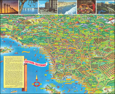
![[ Southern California Tourism ] Hunting and Fishing in Southern California on the Santa Fe](https://storage.googleapis.com/raremaps/img/small/101613.jpg)