|
||

|

|
|

|
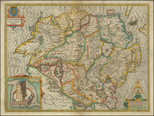
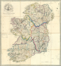
Ireland. From the Best Authorities, with The Distances laid down in British Statute Miles published by M.H. & J.W. Allen in Dublin in 1832 is a rare and remarkable cartographic representation of Ireland. The map is noteworthy for its publication in Dublin, which was an uncommon occurrence for maps of Ireland during that time.
Hand-colored in outline, this map presents a detailed view of the country's geography, marking various towns, villages, rivers, canals, and roads. Distinctive symbols are used to represent various features, such as Borough Towns, Market Towns, Post Towns, Mail Roads, and more, and an explanatory section helps to decipher these symbols. The map even includes measurements in British statute miles, reflecting the influence of British rule, as Ireland was part of the United Kingdom in the 1830s.
By providing a snapshot of Ireland before the Great Famine of 1845, the map offers a unique window into a period marked by significant political and social change. The rise of nationalist movements and ongoing tensions with the United Kingdom provide the backdrop for this map, which can be seen as an essential resource for historians and researchers studying the era.
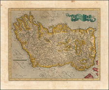
Notable features such as the crowned harp in the title cartouche add a touch of artistic flair to the map, emphasizing Ireland's cultural heritage.
Overall, this Dublin-published map of Ireland is a scarce and fascinating piece, rich in geographical detail and historical context. Its existence as a product of the time it represents makes it an invaluable asset for anyone seeking to understand Ireland during a transformative and tumultuous period in its history.