|
||

|

|
|

|
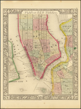
Transit map of Manhattan and the Bronx published in May, a few months before the city's first subway line opened in October 1904. New York's first subway line, operated by the Interborough Rapid Transit Company (IRT), opened in 1904 and is shown here in a double-thick line, including the Brooklyn extension on the IRT Eastern Parkway Line; the original twenty-eight stations are listed (1-28) on the inner cover. A dashed line extends from the Wendover Avenue (now Claremont Parkway) stop on the Third Avenue El north through Bronx Park. This routing through the park was changed after concerns about the zoo animals' welfare were raised, with the City Club taking a strong stand against it. In Morrisania, the New York Driving Club track, which closed in 1898, is marked in orange dashed lines.
Penn Station is shown as a rectangle, shaded with speckling, below a thick dashed line for the Pennsylvania Railroad Tunnel, or North and East River Tunnels, which opened in 1910.
The map bears an advertisement for the former Sohmer Piano Company, whose Robert Maynicke-designed Beaux-Arts building still stands today, opposite the Flatiron Building.
![[Brooklyn] The Anderson T. Herd Realty Co's Map of the Borough of Brooklyn & Part of Queens with Present & Projected Transit Lines, Elevated & Surface Railways, Bridges, Tunnels & Subways . . . 1906](https://storage.googleapis.com/raremaps/img/small/84230.jpg)
![Map of the State of New York with Part of Upper Canada [Large inset plan of New York]](https://storage.googleapis.com/raremaps/img/small/91848.jpg)