


|
||

|

|
|

|
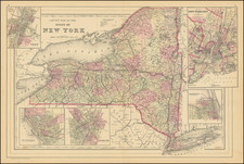
This is a comprehensive guide to New York City below 131st Street as prepared by the "Committee of '92," and specifically tailored to the needs of the delegates attending the Eleventh International Christian Endeavor Convention. The pocket map was designed by Rand, McNally & Co.
Covering several important details for convention attendees, the map includes specific hotel locations for each state delegation, as well as directions to the convention venue, Madison Square Garden, from various parts of the city.
The map is quite detailed, pinpointing more than 32 hotels, each associated with one or more states. For example, the Ashland at Fourth Ave. & 24th Street is listed as the headquarters for delegates from Arizona, California, Colorado, Idaho, Nevada, New Mexico, Utah, Washington, and Wyoming.
It also offers a comprehensive guide on how to reach Madison Square Garden from various key locations in the city such as Battery, Barclay St. Ferry, Brooklyn Bridge, City Hall, Chambers St. Ferry, Christopher St. Ferry, Cortlandt St. Ferry, Desbrosses St. Ferry, Fourteenth St. Ferry, Grand Central Depot, Hotels on Broadway, Liberty St. Ferry, and Twenty-Third St. Ferry. It also lists the nearest elevated railroad stations to Madison Square Garden.
The Madison Square Garden itself is described as being bounded by 27th St. on the north, 26th St. on the south, Fourth Ave on the east, and Madison Ave on the west side.
This guide was evidently a helpful resource for the delegates, allowing them to navigate the bustling city of New York with ease, find their accommodation, and reach the convention site without any trouble.
Rand McNally & Co. is a large American map and navigation company best known for its annual atlases. The company got its start in 1856, when William Rand opened a print shop in Chicago. He was joined in 1858 by a new employee, Andrew McNally. Together, the men established their namesake company in 1868. Originally, the company was intended to print the tickets and timetables for the trains running to and through Chicago; their first railway guide was published in 1869.
By 1870, they had shifted from just printing to publishing directories, travel guides, and newspapers. Their first map appeared in 1872 in a railway guide. The map was produced using a new wax engraving method, a cheaper process that gave the company an edge.
By 1880 Rand McNally had entered the education market with globes, wall maps, and geography texts for students. In 1923, Rand McNally published the first Goode’s World Atlas, named after its editor, Dr. J. Paul Goode. For generations afterward, this would be the standard classroom atlas.
In 1899, William Rand left the company, but McNally and his family remained, controlling the company for over a century. In 1904, they published their first road map intended for automobiles and by 1907 were publishing Photo-Auto Guides, which combined photography and mapping to help drivers. In 1924, they produced the Auto Chum, a precursor to their famous road atlases. Rand McNally would remain the leader in road maps and atlases throughout the twentieth century.
In 1937, Rand McNally opened its first store in New York City. Ever on the frontier of technology, Rand McNally pioneered the scribing process for printing tickets in 1958 and printed their first full-color road atlas in 1960. Arthur Robinson developed his now-famous projection of Rand McNally in 1969. By the 1980s, the company was exploring digital reproduction and digital databases of maps for truckers. In the 1990s, they lead the charge to develop trip-planning software and websites. Today, most of its products are available online or in a digital format, including maps for tablets and phones.

![[Charles Lindbergh] Spirit of St. Louis](https://storage.googleapis.com/raremaps/img/small/69234.jpg)
![[Brooklyn] The Anderson T. Herd Realty Co's Map of the Borough of Brooklyn & Part of Queens with Present & Projected Transit Lines, Elevated & Surface Railways, Bridges, Tunnels & Subways . . . 1906](https://storage.googleapis.com/raremaps/img/small/84230.jpg)
![[ Manhattan Island / New York City ] To His Excellency Sr. Henry Moore Bart. Captain General and Governour in Chief in & over the Province of New York and the Territories . . . This Plan of the City of New York and its Environs, Surveyed and Laid Down: Is most Humbly Dedicated . . . B. Ratzer](https://storage.googleapis.com/raremaps/img/small/105080.jpg)