|
||

|

|
|

|
Rare First Edition.
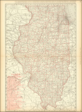
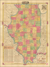
Early lithographed map of Illinois by Horace Thayer, published in New York City in 1852.
In the upper-left corner is a population table for Illinois which shows the changes in county population from 1840 to 1850. During that decade, the population of Cook County grew from 10,201 to 43,385. In 1850, every single county in Illinois (save for two) had a larger population than Los Angeles County in the newly created state of California.
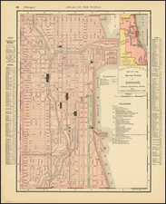
In the lower-left corner is a detailed street plan of Chicago showing railroads and the boundaries of the wards.
This is likely the first edition of Thayer's map as the title date (1852) matches the imprint date. Rumsey (3190) has the 1853, which seems to be a bit more common, also with a catalog on the front pastedown.
Rarity
We find no examples of the 1852 edition of the map (nor anything earlier) in OCLC.