|
||

|

|
|

|
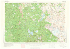
Fine map of the coastline from Monterey and San Francisco in the south to Cook Inlet and Mount Redoubt in the north, with a large inset of the area around Cook Inlet, Anchorage and Prince William Sound, based upon the Spanish explorations in the region at the end of the 18th Century.
The map tracks the Spanish discoveries at the end of the 18th Century, most notably, the discoveries of Bruno de Heceta and Juan Francisco Bodega y Quadra in 1775 and Ignacio de Arteaga y Bazan and Bodega y Quadra in 1779. The Spanish had initially sent an expedition to the Northwest for purposes of discovery and in search of possible Russian colonization efforts in 1774, led by Juan Perez, which failed to reach its goal. In the 1775 expedition, Heceta and Bodega y Quadra reached Point Grenville and Destruction Island in Washington in July 1775, before a skirmish with the Indians (at Punta de los Martires, where a small group of Bodega y Quadra's men were killed by the locals) and scurvy persuaded Hecta to turn back, while Quadra proceeded as far north as the area near modern day Sitka, without finding any evidence of Russian colonies. The names along the coastline to the north of Punto de la Trinidad are primarily those utilized by Bodega y Quadra or Heceta in the official report of the expedition.
On his trip south, Heceta discovered the mouth of the Columbia River (marked on the map as Entrada de Hezeta), although the strong currents prevented significant explorations.
In 1779, Arteaga and Bodega y Quadra made a second expedition to the region, with the intent of exploring the region and potentially observing any English navigators in the region, and in search of the Northwest Passage. The expedition carefully surveyed Bucareli Bay, before proceeding as far north as Prince William Sound, Cook Inlet and the Kenai Peninsula, encountering no English navigators, but making significant observations along the Northwest Coast of America, although without mention of the massive inland waterways.
Wagner states that the map was copied by Lopez from a manuscript map by Juan Pantoja y Arriaga and the inset derived from a manuscript map by Josef Camacho, who was serving as "primera piloto" on the mission. La Perouse obtained a copy of the expediton map, which was published in 1798 and a journal of the expedition was acquired an published in 1798 by Daines Barrington.
The map is one of 7 known maps prepared by Tomas Mauricio Lopez, son of Spain's most famous mapmaker, Tomas Lopez, and one of only two maps to include the name of Tomas Mauricio Lopez.
Lopez's map is very rare. We locate only one example in a dealer catalog in the past 100 years (Maggs Brothers, 1923). We locate only a few known examples in American institutional collections, as well as the British Library and National Library of Spain.
Tomás López de Vargas Machuca (1730-1802) was one of Spain’s most prominent cartographers in the eighteenth century. He was born in Toledo but studied at the Colegio Imperial in Madrid, where he focused on mathematics, grammar, and rhetoric. Along with a small group of colleagues, in 1752 the Spanish government sent López for training in Paris with the renowned geographer Jean Baptiste Bourguignon d’Anville. When he returned to Spain he was named Geógrafo de los dominios de Su Magestad and put in charge of the geographic collections of Charles III. He published many maps, including his fascinating maps of the Americas, and a variety of geography manuals. Some of his most famous maps are of the Iberian Peninsula, part of his large project to create a majestic atlas of Spain. Unfinished in his lifetime, López's children published the Atlas Geográfico de España (Geographical Atlas of Spain) in 1804. It was republished in 1810 and 1830.
![(Southern California Photographs) [Western Travel Photo Album with Original Photographs of La Jolla, Los Angeles, Ocean Park (Santa Monica), Venice, Mt. Lowe, California; also photos of Trinidad, Colorado, Arizona, Nova Scotia, and other locations; and a number of Southern California printed picture postcards]](https://storage.googleapis.com/raremaps/img/small/90545.jpg)
![[San Diego County Before Orange, Riverside and Imperial Counties] Sketch Map of San Diego County Showing the Position of Mines and Minerals Referred to in the 6th Annual Report of the State Mineralogist of California . . . .1886](https://storage.googleapis.com/raremaps/img/small/104557.jpg)
![Wines from California | Wine Land of America [Vineyard scene]](https://storage.googleapis.com/raremaps/img/small/93655.jpg)