This item has been sold, but you can enter your email address to be notified if another example becomes available.


|
||

|

|
|

|
Stock# 30074
Description
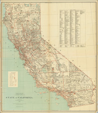
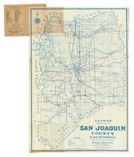
Detailed map of California and Nevada, colored by counties, published for Jones Illustrated Historical Atlas.
The map shows towns, railroads, islands, rivers, mountains, roads, springs, sinks and a host of other details. Pre-dates the formation of Orange, Riverside and Ventura Counties, among others.
Many counties still not shown. Includes many early county configurations which predate the formation of the modern counties.
![[Orange County Ranchos -- Signed by Orange County Surveyor]](https://storage.googleapis.com/raremaps/img/small/92333.jpg)