|
||

|

|
|

|
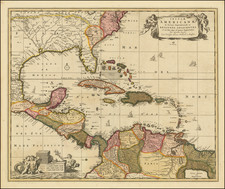
Rare First State of One of the First Maps of Florida Territory
Striking example of the first state of Tanner's Map of Florida, from Tanner's monumental New American Atlas, without question the finest of all 19th Century American commercial atlases.
Tanner's map of Florida is one of the earliest obtainable maps of Florida Territory. The map is virtually identical to Charles Vignole's map of 1823, with the only difference being the lack of Vignole's name on the map.
Miami is shown as Cape Florida Set. A number of old Spanish Land Grants are shown, including Fleming's Grant, Arredordo's first and second grant, Miranda's Grant, Delespine's Grant and Hackley's Lands. Several early roads appear, along with many annotations.
Tanner first conceived of the atlas in 1818 and began publishing it in serial/subscription format in 1819. Issued over a 5-year period, when finally completed, it marked the first American Atlas which could compete on merit with the quality of European Commercial publishers.
States of the Map
- State 1 (1823): Copyright is dated 20.th day of August 1823. Only 4 counties shown (Duval County, St. John's County, Escambria County and Jackson County.
- State 2 (circa 1825): Gadsden County is shown.
- State 3: (1825): Title notes "Improved to 1825."
- State 4 (circa 1833): Improved to 1825 has been removed from title. Kein /coiyunt added, Nassau County added. Additional changes not noted.
- State 5 (1836): Copyright updated to 1836 and title.
![[ Florida / Georgia Coastline ] A Plan of Amelia Harbour and Bar, in East Florida, Surveyed by Jacob Blamey, Master of His Majesty's Schooner St. John](https://storage.googleapis.com/raremaps/img/small/38028.jpg)

![County Map of Florida [with inset of Mobile]](https://storage.googleapis.com/raremaps/img/small/71599.jpg)
![Boca y Barra Del Rio Sta. Maria [Florida]](https://storage.googleapis.com/raremaps/img/small/43885.jpg)