|
||

|

|
|

|
Stock# 99844
Description
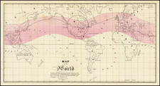
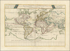
Rare separately published map of the World, crediting James Gilbert in London and George Philip in Liverpool.
Centered on the Pacific Ocean, the map identifies a number of newly discovered areas in the Antarctic.
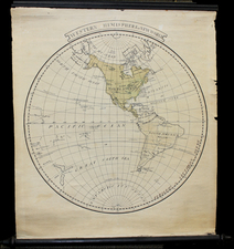
Includes large inset showing the northern and southern hemispheres on the Horizon of London.
A note at the top explains
NOTE. The Cotidal lines show the positions of the top of high water, and the Roman numerals the Greenwich time, at which high water occurs at the several places at new and full moon or the time answering to that, but as the times vary with the seasons and other causes, the lines are merely an approximation.
Condition Description
Segmentedand mounted on original linen with marbled paper self-wrappers. Original full calf wallet-style case, cracks starting at closing flap; map with only minor foxing, else exceptionally nice with bright original colors.