


|
||

|

|
|

|
Stock# 99639
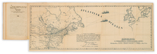
Description
Detailed map of the US, extending west to include a large Texas and the Missouri River Valley.
Indian Territory is called "Terre. de l'Ouest".
Nice detail throughout the map, including Indian tribes, early railroad information, and other detail.
The early formation of a national railroad network can just be seen.
![(American Revolution - Spanish Mapping) Mapa Geografico Que Comprehende La Nueva Inglaterra, Nueva York, Nueva Jersey, Pensilvania, Maryland y Parte de Virginia. [Geographic Map Encompassing New England, New York, New Jersey, Pennsylvania, Maryland, and Part of Virginia.]](https://storage.googleapis.com/raremaps/img/small/95136.jpg)
![[School Girl Map] United States by Betsey C. Converse](https://storage.googleapis.com/raremaps/img/small/66109.jpg)
![(Extremely Rare American View Book) Les Ports de l'Amerique [8 engraved prints of American Cities: Philadelphia, Boston, Savannah, Fredericksburg, Charlestown, Chesapeake Bay, Quebec, and Port Royal] Graveé d'apres le Tableau de Vernet.](https://storage.googleapis.com/raremaps/img/small/95381.jpg)

![A New and Correct Map of North America with the West India Islands, Divided According to the Last Treaty of Peace ... 20th of Jan. 1783 ... Particularly Distinguished the Thirteen Provinces which Compose the United States . . . [With annotations describing Cumberland, Tennessee, Kentucky etc.]](https://storage.googleapis.com/raremaps/img/small/41651.jpg)