|
||

|

|
|

|
Stock# 99160
Description
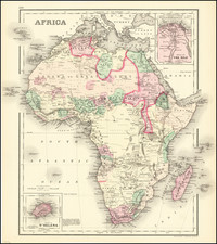
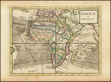
Striking large highly detailed map of Afrcia, colored by colonial regions (English, Spanish, French, Dutch, Turk, Portugese, American, etc.)
The interior knowledge is well illustrated, including large unexplored parts of Central Africa. North Africa is criss-crossed with trade routes, whereas the rest of the Continent is largely without interior roads. A gorgeous example of mid-19th Century French African cartography.
Dufour's Atlas Universel was one of the great large format French atlases of the mid 19th Century.