|
||

|

|
|

|
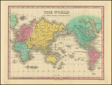
Interesting map of the World on Mercator's Projection, centerd on the Pacific Ocean and Australia.
The map is noteworthy for the wide open and inviting prospect of a northwest passage and the representation of the South Shetland Islands (located about 70 miles north of the Antarctic mainland), which were first sighted in 1819 by William Smith, prior to the "discovery" of the Antarctic Continent.
The Antarctic continent was first sighted the following year in 1820 by a Russian expedition led by Fabian Gottlieb von Bellingshausen and Mikhail Lazarev, who spotted the ice shelves at the edge of the continent. Their sighting was closely followed by the British naval officer Edward Bransfield, who also sighted the mainland in 1820, and the American sealer Nathaniel Palmer, who is credited with seeing the continent later that same year.
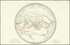
![[World Map--The Prophet Daniel's Dream]](https://storage.googleapis.com/raremaps/img/small/82774.jpg)
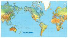
![[World] Air France --](https://storage.googleapis.com/raremaps/img/small/93647.jpg)