|
||

|

|
|

|
Striking map of the world and decorative vignette, offering a visual account of the world's major religious distributions as understood at the time of its creation.
The map is richly detailed and colored to differentiate various regions according to the predominant religious beliefs and practices, including Christians, Muslims, "Bramas & Buddhists" and Pagans.
At the core of the map is a world view, segmented by color to represent different religions. Each color corresponds to a religion or a group of religious beliefs, making it easy to see at a glance the geographical spread and concentration of religions across continents.
The table depicted in the inset of the prior map is a "Diagrama de la Educacion en Europa" (Diagram of Education in Europe), which appears to categorize the population of Europe by religious denomination and their corresponding levels of education. The table is organized into color-coded sections, each representing a different religious group: Catholics, Protestants, Christians (likely referring to Eastern Orthodox Christians), Jews, and Muslims. The height of the bars seems to indicate the number of adherents or the level of educational attainment within each religious group, quantified on the vertical axes.
On the left, a separate bar chart titled "Poblacion terrestre calculada en 1,400,000,000 se descompone asi" (Terrestrial population estimated at 1,400,000,000 is broken down as follows) breaks down the world's population by continent or region, each region color-coded consistently with the religious demographics chart to the right.
Beneath the main diagram, a line with markers seems to represent the scale of the chart, with each unit likely indicating a specific number of kilometers or a demographic value. The bottom right corner of the diagram is labeled "Rusia," indicating a significant portion of the population or educational level pertaining to Russia, which may correspond to the Eastern Orthodox demographic.
Flanking the map are two large panels filled with text, presumably offering detailed explanations and insights into the distribution of religions
Above the cartographic display, an elaborate illustration depicts various religious figures and iconography. These vignettes serve both as a symbolic representation of the map's subject matter and as a reflection of the artistic style of the period.
Otto Neussel, the creator of this map, likely compiled it with a meticulous approach to the data of his time. While not much may be known about Neussel without further research, his work suggests a dedication to providing a comprehensive and comparative perspective on world religions. His map stands as a testament to the educational and cultural values of the era, aiming to enlighten viewers about the complex tapestry of global faiths through the lens of geography and statistics. It would have been a valuable resource for scholars, educators, and those interested in the global distribution of religious practices.
![[Signed Political Satire Artwork] Vietnam ... Vietnam ... Vietnam ...](https://storage.googleapis.com/raremaps/img/small/68726.jpg)
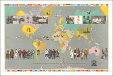
![[Pan American Menu Map] (World)](https://storage.googleapis.com/raremaps/img/small/104021.jpg)
![Historiarum Indicarum Libri XVI [with:] Indiarum Orientalium Occidentaliumque Descriptio. Pet. Maffei Historiae Harum Verissimae, Dedicata.](https://storage.googleapis.com/raremaps/img/small/102793.jpg)