|
||

|

|
|

|
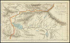
Stock# 97480
Description
American Air Force Aeronautical map featuring the Yalu River valley (later to become infamous during the Korean War), showing the area from Liaoyang east to Furugelm Island and from Hsinking (Changchun) south to Kango (Hamhung).
A thick dashed line shows the boundary between the Manchuoko, the Japanese puppet state, and Chosen, Japanese-occupied Korea.
Condition Description
Manuscript titling "Manchuria" in pen at lower left.
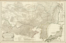
![Sarmatia Utraque Europaea et Asiatica [Ancient Russia from both Europe and Asia]](https://storage.googleapis.com/raremaps/img/small/82027.jpg)