|
||

|

|
|

|
Havana in 1853
The 1853 plan of Havana, originally engraved in 1849 by W.S. Barnard in New York, stands as a fascinating testament to the era's intricate cartographic craft. The map offers an intimate, detailed look into Havana's bustling streets, distinguishing landmarks, and the ornate architecture that made the city iconic in the 19th century.
This plan doesn’t merely serve to orient its viewers to the streets and byways of Havana. The 14 decorative vignettes embellishing the map's margins provide an immersive visual exploration into Havana's key institutions, attractions, and buildings. These artistic representations showcase the cultural, architectural, and historic essence of the city.
Brief Historical Explanation of the 14 Buildings:
-
Fuenta de la Habana en el Paseo de Isabel: A famous fountain located in the Paseo de Isabel, a central promenade in Havana.
-
Estatua De Carlos 3e: A statue of Charles III, a significant Spanish monarch known for his reforms.
-
Gran Teatro De Tacon: Renowned theatre and cultural institution in Havana.
-
Real Carcel y Presidio: Havana's main prison and detention facility at the time.
-
Catedral: The Havana Cathedral, an example of colonial baroque architecture and an iconic religious structure in Havana.
-
Hospital Militar: The Military Hospital
-
Deposito De Villanueva o Paradero del Ferro-Carril: The main train station, marking the advent of rail transportation in Cuba.
-
Castillo Del Morro: A historic fortress guarding the entrance to Havana harbor.
-
Vista General De La Habana: A panoramic view of Havana, showcasing its skyline and coastal beauty.
-
Deposit Del Gas: A significant infrastructure that marked Havana's modernization efforts in the energy sector.
-
Templete: A neoclassical monument marking the spot where the first mass was held in Havana.
-
Quinta Del E.S. Conde De La Fernandina: The residence of the Count of Fernandina, reflecting the grandeur of aristocratic life in 19th century Havana.
-
Rl. Casa De Beneficencia: A charitable institution or asylum that catered to the city's destitute.
-
Palacio De Gobierno: The Government Palace, a symbol of political authority and power in Havana.
Translation and Explanation of Quoted Section:
Numeros de las casas. Los números colocados en las manzanas indican el mayor que tienen las casas de la acera en cuyo centro se hallan. Si pues, es facil saber v.g. que la casa n. 114 calle del Obispo se halla entre las calles de la Habana y Aguiar, porque en una de las aceras de esta cuadra estan comprendidas las casas que llevan desde e n. III (que es el que sigue al 110, mayor entre Comopostela y la Habnaa) hasta el 115 indicade el último de dicha cuadra La casa n.109 calle de Sol, ha de hallarse entre las de Cuba y Aguiar.
Translation: "Numbers of the houses. The numbers placed on the blocks indicate the highest number that the houses on that side have. Thus, it's easy to know, for example, that house no. 114 on Obispo street is located between Havana and Aguiar streets, because on one of the sidewalks of this block are the houses that range from no. 111 (which is the one that follows 110, the highest between Compostela and Havana) to 115, indicating the last of that block. House no. 109 on Sol street must be between Cuba and Aguiar streets."
This note provides insight into the system used to number the houses on the map and facilitates locating specific addresses by contextualizing them within street intersections.
Rarity
All editions of the map are quite rare. This is the first example of the 1853 edition we have offered for sale.
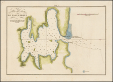
![[Havana / Approved by the Chart Committee of the Admiralty] Plan of the Harbour and city of the Havana, surveyed by Don Joseph de Rio, Captain in the Spanish Navy. 1798 . . . 1805](https://storage.googleapis.com/raremaps/img/small/89455.jpg)
![[Cuba] Croquis de la Provincia De Puerto Principe Formado por el E. M. de la Capitania General de la Isla de Cuba ampliado y stampado en colors por el Deposito de la Guerra 1896](https://storage.googleapis.com/raremaps/img/small/33368.jpg)
![Cuba, Jamaica and Porto Rico [Cayman Islands]](https://storage.googleapis.com/raremaps/img/small/78708.jpg)
![Cuba Insula [with] Hispaniola Insula [with] Insula Jamaica [with] Ins. S. Ioannis [with] I.S. Margareta Cum Confiniis](https://storage.googleapis.com/raremaps/img/small/95802.jpg)