


|
||

|

|
|

|
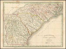
One of the Earliest Printe Maps of Myrtle Beach, South Carolina
Fine large format map of Myrtle Beach, South Carolina, drawn in the year of its incorporation by one of its most important early civil engineers, T.M. Jordan.
Created in the year of its incorporation, this map of Myrtle Beach is one of the earliest printed maps of Myrtle Beach, pre-dated only by Sanborn Fire insurance maps of the town. This is Jordan's second significant map of the region, pre-dated by his 1930 Map of the South Carolina Coast from Little River to Georgetown . . .
In July 1938, T.M. Jordan, a civil engineer, crafted a detailed map of Myrtle Beach, segmenting the city into distinct sections from south to north, which was later revised in 1938. These sections include:
- Midway
- Hurl Rocks
- Withers Heights
- Yaupon Circle
- South Myrtle
- Hotel
- East Chester
- Booker T. Washington
- Washington Park
- Kings Highway
- Myrtle Heights
- Oak Ridge
- Knox Acres
- Oak Park
- The Dunes
- Forest Lake
- Fairway Park
- Pine Lake Estates
- Ocean Forest
- Golf Course
- Highlands
- Colonial Heights
- Forest Dunes
These section names have stood the test of time and are still in use today, even reflected in the city's street signage. Historically, these sections even influenced phone numbering conventions. For instance, a resident of Myrtle Heights might have had a phone number like "Myrtle Heights 1234." As Myrtle Beach expanded over the years, new areas were incorporated, either merging with existing sections or introducing new section names.
Myrtle Beach, South Carolina
In 1881, the foundation for what would become Myrtle Beach was set when the Burroughs and Collins Company procured vast land areas. Initially centered around naval stores and timber operations, the company soon transitioned its ambitions towards establishing the area as a beach resort. By 1900, with the establishment of rail links between Conway and Myrtle Beach, the beachfront began to allure vacationers.
It was during this time that the area, previously dubbed New Town, was christened "Myrtle Beach" in homage to the region's abundant native myrtle bushes. The opening of attractions, notably the Sea Side Inn and the Pavilion in 1901, marked the start of its journey as a tourist magnet. The oceanfront, with lots sold at incredibly affordable rates, saw burgeoning growth in the form of cottages and essential amenities.
However, it was the 1920s and 1930s that brought transformative developments to Myrtle Beach. Visionary investor John T. Woodside in the 1920s visualized an expansive community named Arcady. Envisioning a luxurious beach resort with a grand hotel, a country club, and a golf course, he undertook monumental projects. Despite the challenging backdrop of the Great Depression, landmarks like the Pine Lakes International Country Club and the Ocean Forest Hotel were birthed.
It's essential to highlight the role of professionals like T.M. Jordan during this period. As a civil engineer, Jordan, collaborating with others like Stanley H. Wright, played a pivotal role in infrastructure development, particularly in the street layouts during the era of John T. Woodside's vision.
Further pushing the developmental frontiers, the late 1920s and 1930s witnessed the opening of sections like Myrtle Heights, Oak Park, and the Dunes for residential expansion. Crucially, in 1929, roads connecting key areas were paved, enhancing accessibility and connectivity. Moreover, the 1930s saw the establishment of notable structures like the 2nd Avenue Pier, boosting Myrtle Beach's reputation as a fishing and recreational hub.
Myrtle Beach was incorporated in 1938 and became a city in 1957, when the permanent population first topped 5,000.
By the 1940s, preluding its post-war boom, Myrtle Beach had successfully melded its rich history with strategic developmental endeavors, setting the stage for its ascendancy in the latter half of the 20th century.
Rarity
The map is very rare.
OCLC does not locate any examples. We note 1 example in the Chapin Memorial Library).


![(Colonial Charleston, South Carolina) This Indenture... [Land documented signed at Charles Town, South Carolina, 14th of August, 1772 by William and Ann Holmes]](https://storage.googleapis.com/raremaps/img/small/92691.jpg)
![[ Virginia, Carolinas, Georgia ] Carte De la Virginie . . .](https://storage.googleapis.com/raremaps/img/small/41731.jpg)
![The City of Savannah Georgia [with] The City of Charleston South Carolina](https://storage.googleapis.com/raremaps/img/small/71779.jpg)