|
||

|

|
|

|
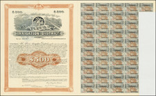
Stock# 96547
Description
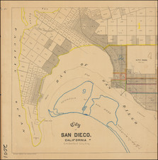
Southwestern Part of Camp Pendleton
Large detailed map showing the marshlands near the mouth of the Santa Margarita River, as surveyed in October 1900.
The map shows the area south of Rancho Santa Margarita y Los Flores, which is adjacent to the northern limits of Oceanside.
The area shown seems to be immediately north of the area of today's Camp Pendleton South.
![[ Downtown St. Helena ] Mattioli's in your Pocket Guide St. Helena -- 13th Annual Edition [ Napa Valley, CA ]](https://storage.googleapis.com/raremaps/img/small/102768.jpg)