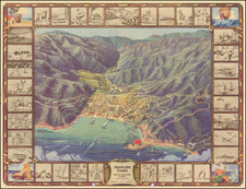
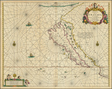
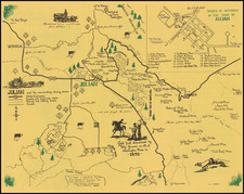
|
||

|

|
|

|
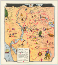
Including Routes of Explorers
Scarce German map showing the progress of the Wheeler Expedition, from Petermann's Geographishce Mittheilungen.
Among the great achievements in the history of western exploration and cartography, the Wheeler Expedition holds a prominent place. The renowned German cartographer, Augustus Petermann, seized this opportunity to publish a map titled "Lieut. Wheeler's Expedition In California, Nevada, Arizona, 1875" in Gotha in 1876. The map was featured in Petermann's Geographishce Mittheilungen (Geographical Communications), a respected German periodical that provided the latest updates on global geographical explorations. This unique piece of history provides a detailed account of the Expedition's journey, the routes taken, and the remarkable features of the land traversed.
The Wheeler Expedition was part of the broader US geological survey initiatives in the late 19th century, aiming to chart and explore the western territories. Led by Lieutenant George Wheeler, the Expedition was a significant scientific endeavor, carrying out topographic surveys, studying natural resources, and collecting data on the local Native American tribes.
Petermann's map precisely represents this historic journey, emphasizing the different divisions of the expedition. These include the routes of Eric Bergland, Lieutenant Birnie, Lieutenant Wheeler, and Lieutenant Whipple. Each division had its own distinct path, each meticulously delineated in the map. Particularly notable is the route through the Mining District, showcasing the valuable resources in the area, which was a point of high interest for American and European investors at the time.
In addition to the routes, Petermann's map exhibits a comprehensive array of geographical, cultural, and anthropological details. The vast wilderness of the American west is shown in great depth, with features like mountains, rivers, and roads meticulously represented. The map also acknowledges the presence of forts and wells, essential for any traveler or settler in these hostile lands.
However, it was not only the physical features that Petermann paid attention to; his map also presents fascinating sociocultural details. Native American villages are marked, hinting at the rich indigenous cultures of the region. Moreover, Indian Reservations are also shown, reflecting the difficult reality of Native American displacement and confinement during this period.
Furthermore, the Petermann map was one of the most detailed European-published maps of the American West at the time, marking its exceptional significance.
August Heinrich Petermann (1822-1878) is a renowned German cartographer of the nineteenth century. Petermann studied cartography at the Geographical Art-School in Potsdam before traveling to Edinburgh to work with Dr. A. Keith Johnston on an English edition of Berghaus’ Physical Atlas. Two years later he moved to London, where he made maps and advised exploratory expeditions as they set off to explore the interior of Africa and the Arctic.
In 1854, Petermann returned to Germany to be Director of the Geographical Institute of Justus Perthes in Gotha. There, he was the editor of the Geographische Mittheilungen and Stieler’s Handatlas. The Royal Geographical Society of London awarded him their Gold Medal in 1860. He continued his interest in exploration in Germany, fundraising for the German Exploring Expeditions of 1868 and 1869-70, which sought an open Arctic sea. Tragically, he committed suicide in 1878.
![(Early California Trade) [Royal Decree of October 22,1803, to encourage trade in California]. D. Joseph de Yturrigaray, Caballero profeso de la Orden de Santiago, Teniente General de los Reales Exércitos, Virrey, Gobernador...Con fecha de 22 de Octubre del año proximo anterior...la Real Orden...Con objeto de fomentar la Agricultura y Comercio de las Californias, se ha servido el Rey habilitar sus Puertos en calidad de menores...](https://storage.googleapis.com/raremaps/img/small/93851.jpg)