


|
||

|

|
|

|
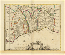
Carte d'une Partie de la Coste d'Afrique Depuis Tanit Jusq'a la Riviere du Senegal, by the French cartographer Jacques Nicolas Bellin and published in Paris in 1757, elegantly portrays the stretch of the African coast extending from Tanit to the mouth of the Senegal River. Bellin's cartographic mastery is beautifully evidenced in this ornate map, adorned with a decorative cartouche and compass rose.
Casting a light on the historical context, the mid-18th century was a period of intensified European engagement in Africa, particularly in terms of trade and exploration. Bellin, serving as Hydrographer to the King, was instrumental in documenting these new discoveries and the shifting geopolitics of the era. This map was created during the peak of his career, as he was producing some of the most influential and detailed maritime charts of the period.
The Carte d'une Partie de la Coste d'Afrique Depuis Tanit Jusq'a la Riviere du Senegal provides a meticulous representation of the African coastline. Its focus on the region from Tanit to the Senegal River is noteworthy, as these areas held significant strategic importance for maritime navigation and were central to the transatlantic trade, including the tragic commerce of enslaved Africans.
Jacques-Nicolas Bellin (1703-1772) was among the most important mapmakers of the eighteenth century. In 1721, at only the age of 18, he was appointed Hydrographer to the French Navy. In August 1741, he became the first Ingénieur de la Marine of the Dépôt des cartes et plans de la Marine (the French Hydrographic Office) and was named Official Hydrographer of the French King.
During his term as Official Hydrographer, the Dépôt was the one of the most active centers for the production of sea charts and maps in Europe. Their output included a folio-format sea atlas of France, the Neptune Francois. He also produced a number of sea atlases of the world, including the Atlas Maritime and the Hydrographie Francaise. These gained fame and distinction all over Europe and were republished throughout the eighteenth and even in the nineteenth century.
Bellin also produced smaller format maps such as the 1764 Petit Atlas Maritime, containing 580 finely-detailed charts. He also contributed a number of maps for the 15-volume Histoire Generale des Voyages of Antoine François Prévost.
Bellin set a very high standard of workmanship and accuracy, cementing France's leading role in European cartography and geography during this period. Many of his maps were copied by other mapmakers across the continent.

![[The First Maps Printed Color] Cartes en Couleur des Lieux Sujets aux tremblements de Terre Dans toutes les parties du Monde Selon le Sisteme de l’impulsion Solaire](https://storage.googleapis.com/raremaps/img/small/52293op.jpg)