|
||

|

|
|

|
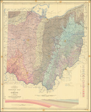
Intriguing hand-drawn map depicting the spread of Azoic strata across the northern US and southern Canada, alongside depictions of characteristic geological features from the map. Azoic strata is an outdated term that refers to geological layers or rock formations that were thought to be devoid of any signs or evidence of life or organic remains.
Presumably the work of an advanced geology student or conceived as a teaching aid for a professor, the map details the coverage of Azoic strata (highlighted in red), which extends through the north of the map. There is also an, apparently misattributed, area with Archean starts in the south. Surrounding the map are artistic depictions of "Beds of Iron Ore" (now commonly known as "Banded Iron Formations") while at the top of the map, the usually-convoluted nature of the oldest Azoic sediments are shown.
The depiction of fossils in the lower left includes some misunderstandings of fossil evidence. The work claims that "the only forms of plant life were the sea weed and of animal life minute animalculae." In fact, recent work has shown that large, complex organisms were alive during the last part of this period, now known as the Ediacaran.
Today, the term Azoic, which literally means "without life," has fallen by the wayside. It has been replaced with the more modern terms Archaen and Proterozoic, which, combined, span from the earliest period of modern earth (about 4 billion years ago) to the start of the Cambrian, roughly 550 million years ago.
We conclude that the map is from circa 1890, based on the use of the term Azoic, which would see a sharp decline in usage after 1900. This is consistent with the dating of a map of the Carboniferous era that we attribute to the same creator, which seems to show an understanding of that period consistent with the late-19th-century.
![[Wisconsin] General Map of the Lead Region Showing the Distribution of the Lodes . . . By James Wilson, Jr. 1880](https://storage.googleapis.com/raremaps/img/small/59314.jpg)
![Gen. Washington [On The Battlefield At Trenton] Engraved by W. Warner from the original picture by Col John Trumbull](https://storage.googleapis.com/raremaps/img/small/103233.jpg)