|
||

|

|
|

|
An Unparalleled Look at the Colonial Partitioning of Southern Africa.
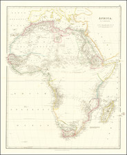
Africa South of the Equator Showing existing Boundary Treaties by George Cawston, published by Edward Stanford in London, presents a rich tapestry of geopolitical detail and delineation of international boundaries in late 19th-century Africa. It covers the area of Africa south of the northern Congo Free State and includes an inset of England, offering a comparative scale.
The map carries a wealth of information about international treaties and agreements which shaped the political landscape of Africa during the late 19th century. It meticulously documents the myriad treaties and conventions that carved out spheres of influence for various European powers in Africa, highlighting the geopolitical complexities of the colonial era.
The map also marks significant political regions and entities of the time. For example, it highlights Msiri's Kingdom, a pre-colonial African state in the approximate location of the present-day Democratic Republic of Congo. It refers to regions like Transvaal, Zulu Land, and Basuto Land, which later became part of modern-day South Africa. It mentions the Orange Free State, a 19th-century Boer republic which was later incorporated into the Union of South Africa. Furthermore, the map shows the Cape Colony, a British colonial administration in present-day South Africa.
Several conventions and agreements are specified, many of which date back to the crucial period of 1884-1887, a time marked by intense negotiation and conflict over territorial claims. The Convention F&AIC and Convn P&AIC, presumably referring to France, Portugal, and possibly a colonial company, and their February 1885 agreements, are noted in several instances.
The "Boundary of Free Trade Area General Act of Berlin Conference Art i 26 Feb 1885" refers to the major international agreement from the Berlin Conference, which marked the beginning of the formal colonization of Africa by European powers. The conference aimed to establish a general policy of free trade in central Africa, creating a so-called "Free Trade Area".
References to "British Sphere of Influence" and "German Sphere of Influence" reflect the colonial powers' influence in different regions. For instance, the "British Imperial East Africa Company" and the "German East Africa Co." hint at these colonial entities' control over trade and governance in these areas.
The numerous references to agreements and conventions show a complex web of diplomatic relations between different entities. These treaties were often designed to resolve territorial disputes and establish areas of control and influence.
Overall, this map serves as a remarkable historical document, illustrating the complex geopolitical landscape of Africa during the late 19th century. It gives us a snapshot of a time of extensive colonial intrusion, with various European powers vying for control over different regions of the continent.
Berlin Conference
In 1885, the Berlin Conference was held, where the world powers decided to divide up Africa, and that maintaining colonies was a necessity. Five years later most of Africa is under colonial rule. The only two countries that remain independent throughout this carving up is Ethiopia and Liberia. Liberia is under U.S. protection and Ethiopia was a Christian kingdom so it is deemed civilized by the Europeans. This did not deter the Italians from trying to colonize Ethiopia, which would ultimately lose the colonial war and Ethiopia would remain Independent.
George Cawston
George Cawston was one of the founders of the British South Africa Company. The British South Africa Company was established following the amalgamation of Cecil Rhodes' Central Search Association and the London-based Exploring Company Ltd which had originally competed to exploit the expected mineral wealth of Mashonaland, but united because of common economic interests and to secure British government backing. BSAC was an amalgamation of a London-based group headed by Lord Gifford and George Cawston and backed financially by Baron Nathan de Rothschild, Rhodes, and his South African associates, including Alfred Beit, with the resources of the De Beers Syndicate and Gold Fields of South Africa.
The company received a Royal Charter in 1889 modelled on that of the British East India Company. Its first directors included the Duke of Abercorn, Rhodes himself and the South African financier Alfred Beit. Rhodes hoped BSAC would promote colonization and economic exploitation across much of south-central Africa, as part of the "Scramble for Africa". However, his main focus was south of the Zambezi, in Mashonaland and the coastal areas to its east, from which he believed the Portuguese could be removed by payment or force, and in the Transvaal, which he hoped would return to British control.
Rhodes' ambition was to create a zone of British commercial and political influence from "Cape to Cairo", but this was far beyond the resources of any commercial company to achieve and would not have given investors the financial returns they expected. BSAC was created in the expectation that the gold fields of Mashonaland would provide funds for the development of other areas of Central Africa, including the mineral wealth of Katanga. When the expected wealth of Mashonaland did not materialize, and Katanga was acquired by the Congo Free State, the company had little money left after building railways for significant development, particularly in areas north of the Zambezi. BSAC regarded its lands north of the Zambezi as territory to be held as cheaply as possible for future, rather than immediate, exploitation.
Rarity and Editions
An updated version of the map was published in 1890. Another edition was issued in 1889, as well. We therefore date this map between the last treaty date reference, 1887, and 1888.
Edward Stanford (1827-1904) was a prominent British mapmaker and publisher. A native of Holborn in the heart of London, Edward was apprenticed to a printer and stationer at the age of 14. After his first master died, he worked with several others, including Trelawny W. Saunders of Charing Cross. Saunders oversaw young Edward’s early career, ensuring that he became a Fellow of the Royal Geographical Society. Associations with the Society eventually brought Sanders much business and gave him a reputation as a publisher of explorers. As testament to this reputation, the Stanford Range in British Columbia was named for him by John Palliser.
Stanford briefly partnered with Saunders in 1852 before striking out on his own in 1853. He was an agent for the Ordnance Survey, the Admiralty, the Geological Survey, the Trigonometrical Survey of India, and the India Office. He also controlled the maps of the Society for the Diffusion of Useful Knowledge, another lucrative source of income. In 1857, Stanford founded his namesake Geographical Establishment, with Saunders and A. K. Johnston as engravers. Thereafter, Stanford was known for his “library maps”, particularly those of Africa and Asia.
Addresses and Years of Operation:
- 6 Charing Cross, London (1848): Edward Stanford's initial place of employment at Trelawney Saunders' shop.
- 7 and 8 Charing Cross, London (1853): Stanford expanded his shop to these addresses.
- 55 Charing Cross, London (1873): The shop moved to this larger location.
- 12-14 Long Acre, London (1873): Site of the new print works and current flagship store.
- 7 Mercer Walk, London (2019): Stanfords moved to this address, continuing its legacy.
Stanford's work with Chief Cartographer John Bolton, including the 1858 Library Map of Europe, positioned the company as a leader in quality cartography during a time of exploration and colonialism. Their 1862 Library Map of London earned acclaim from the Royal Geographical Society. With the business thriving, Stanford purchased Staunton & Son in 1877 and, upon retiring in 1885, handed over the reins to his son, Edward Stanford II.
As sole agents for Ordnance Survey Maps, the company's influence and reputation grew, culminating in the Stanford’s London Atlas Of Universal Geography, which was presented to Queen Victoria in 1887. The transition into the 20th century saw further integration of retail, print, and cartographic operations at Long Acre.
During World War I, Stanford's became an essential publisher for the War Office. Edward Fraser Stanford took over in 1917, steering the company through the interwar period and innovations, such as the world’s smallest maps in 1922 and the Daily Mail Motor Road Map in 1926.
Withstanding a bombing in WWII, the company continued under the stewardship of John Keith Stanford and was sold to George Philip & Son in 1947. As it adapted to the digital age, Stanfords received the Ordnance Survey Premier Partner status in 2007 and ventured into online mapping and data services.
Stanfords, now an icon for travellers and explorers, has maintained its cultural relevance and retail success well into the 21st century, underpinned by a legacy of entrepreneurial spirit and commitment to cartographic excellence.
![[Wall Map of Africa] L'Afrique Divisee en ses Principales Parties et ses Isles Tire des Relations les plus Recentes . . . 1782](https://storage.googleapis.com/raremaps/img/small/91459.jpg)