|
||

|

|
|

|
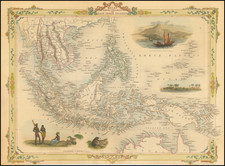
A Plan of the Bay on the Southwest Side Of Pulo Timon, surveyed by William Nichelson in 1763 and published by Laurie & Whittle in 1794, presents a detailed maritime charting of the southwest region of Tionam Island, or Pulau Tioman, off the eastern coast of West Malaysia. The chart maps a large portion of the southwest coast of Tioman Island from its southeast to northwest points and features a depth of mariner-focused information, from soundings and seabed notes to indications of reefs and shoals. The coastal profile offers a straightforward visual of the coastal topography as viewed from the bay, complemented by annotations detailing essential sailing directions based on Nichelson's surveys.
During the 18th century, Pulau Tioman held significance due to its strategic maritime location, as East Indiamen would often sail between the Malaysian Peninsula and the west coast of the island. The chart describes a river (likely representing an important source of fresh water) originating from a mountain waterfall, leading into a sandy bank and forming a clear-water river. The annotations provide clear instructions for anchoring, highlighting the bay's protective qualities, especially during the Northeast Monsoon, and offering guidance on safe wind ranges from north-northwest to south-southeast.
Accurate indications of landmarks, such as rocks visible only during low tide, enhance the map's practicality for navigators. The reference to the English Squadron's anchorage in January 1763 offers a glimpse into the naval activities of the period. In its entirety, the map stands as both a valuable navigational tool and a document of Pulau Tioman's maritime history.
Captain William Nichelson was the Superintendent of the Royal Navy in Bombay.
Robert Laurie (ca. 1755-1836) and James Whittle (1757-1818) formed their Fleet Street, London-based firm upon the 1794 death of their employer Robert Sayer, himself one of the dominant print and mapmakers of the last half of the 18th century.
Laurie & Whittle started managing Sayer's business as early as 1787. They took over all managerial duties when Sayer's health flagged in 1792, and they changed the imprint in 1794 upon his death. Sayer left the two a 21-year lease on the shop (at £100 a year) and on Sayer's Bolt Court premises, as well as an option to acquire stock and equipment at a preferential price of £5,000 payable over three years.
Robert Laurie retired from the firm in 1812, and his role was assumed by his son, Richard Holmes Laurie (1777-1858). The younger Laurie worked with James Whittle until the latter died in 1818. After R. H. Laurie died in 1858, Alexander George Findlay, FRGS (1812-1875) purchased the firm from his daughters. The firm continues today under another name, specializing in yachting charts.
Laurie & Whittle were prolific print and map publishers, and throughout their careers, they produced numerous very important and rare works. They carried on Robert Sayer's atlas business and were responsible for editions of The Complete East-India Pilot and The American Atlas.