|
||

|

|
|

|
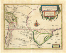
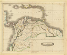
Detailed map of Peru, pubished in Paris by a young Philippe Buache, who would go on to become the pre-eminent French mapmaker of the middle of the 18th Century, along with J.B.B. D'Anville.
The map elucidates the geography of Peru within the broader context of Incan history and the province's contemporaneous condition in the 18th century. Constructed by Philippe Buache and informed by the astronomical observations gathered between 1736 and 1739 by scientists Louis Godin, Pierre Bouguer, and Charles-Marie de la Condamine, the map serves as a testament to a burgeoning era of geographical and scientific exploration. Additionally, the contributions from the Jesuit priest Louis Feuillée and naval officer Amédée-François Frézier enhance its reliability and breadth.
Louis Godin, Pierre Bouguer, and Charles-Marie de la Condamine were among the scientists and scholars dispatched to the equatorial region to participate in the French Geodesic Mission to Peru, aimed at measuring a degree of meridian arc at the equator. Their work was groundbreaking for its meticulous application of astronomical observations and measurements, providing a better understanding of the Earth's shape. Louis Godin (1704–1760) was an astronomer who played a critical role in the preparation and calculation of these measurements. Pierre Bouguer (1698–1758) was another principal scientist in the mission, known for his work in hydrography and optics. Charles-Marie de la Condamine (1701–1774) was not just an explorer but also a geographer, contributing substantially to the fields of cartography and science.
Father Louis Feuillée (1660–1732) was a French Jesuit priest and botanist who undertook missions to South America earlier in the 18th century. His observations, chiefly made in the Andean regions, were considered significant contributions to natural history and geography. Amédée-François Frézier (1682–1773) was a French military engineer and explorer. His voyages along the South American coastline provided detailed accounts that were vital for navigational and cartographical knowledge.
The cartographic work of Philippe Buache brings together the insights from these explorations and observations into a unified visual presentation. The map is richly textured with data on natural topography, Incan ruins, contemporary settlements, and trade routes, making it a multidimensional piece. It serves as both a representation of the scientific knowledge of the period and an indispensable historical document providing insights into the land and culture of 18th-century Peru.
Philippe Buache (1700-1773) was one of the most famous French geographers of the eighteenth century. Buache was married to the daughter of the eminent Guillaume Delisle and worked with his father-in-law, carrying on the business after Guillaume died. Buache gained the title geographe du roi in 1729 and was elected to the Academie des Sciences in the same year. Buache was a pioneering theoretical geographer, especially as regards contour lines and watersheds. He is best known for his works such as Considérations géographiques et physiques sur les découvertes nouvelles dans la grande mer (Paris, 1754).