


|
||

|

|
|

|
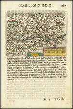
Battle Plan of the Siege of Budapest
Finely executed birdseye view style plan, showing the engagement of the forces of the Ottoman Empire and Holy Roman Empire in 1684.
The Siege of Buda and Pest in 1684 was a significant military campaign in the ongoing conflict between the Ottoman Empire and the Holy Roman Empire, which lasted for several months and resulted in the fall of the city to Ottoman forces.
The Ottoman army, led by Grand Vizier Merzifonlu Kara Mustafa Pasha, was composed of approximately 80,000 soldiers, including janissaries, sipahis, and azaps. They were supported by a fleet of ships on the Danube River. The Holy Roman Empire, led by Charles V, Duke of Lorraine, had a smaller army of around 30,000 soldiers, including German, Austrian, and Hungarian troops. The siege began in July 1684, with the Ottoman army blockading the city and cutting off supplies to the defenders. The Holy Roman Empire attempted to break the siege with a relief army, but it was defeated by the Ottoman forces in a battle outside the city. The defenders were also plagued by disease and food shortages, which weakened their ability to resist the Ottoman army.
The Ottoman army used a variety of siege tactics during the campaign, including mining and sapping, as well as bombardment with artillery. They also used a massive siege tower, known as the "sultan's tower," to breach the city walls. The defenders, however, put up a strong resistance and were able to hold off the Ottoman army for several months.
In September 1684, the Ottoman army finally succeeded in breaching the city walls and entered Buda. The defenders were forced to retreat to Pest, where they made a final stand. However, the Ottoman army was able to capture Pest as well, and the siege ended with the fall of the city to Ottoman forces.
Rarity
The view is extremely rare.
We note examples at the Bibliotheque National de France, British Library, John Carter Brown Library and Bavarian National Library.
We note two example at auction in the past 20 years (Hauswedell and Nolte, 2005 and Reiss & Sohn, 2005). Likely the same example.
Giacomo Giovanni Rossi (1627-1691) was an Italian engraver and printer. He worked in Rome, the heir to an important printing business founded by his father, Giuseppe de Rossi (1570-1639). Giuseppe began the press in 1633 and Giovanni and his brother, Giandomenico (1619-1653) took it over upon his death. The brothers expanded the business and by the mid-seventeenth century it was the best-known printing house in Rome.
For his maps, Giovanni worked with Giacomo Cantelli da Vignola. They produced the Atlas Mercurio Geografico. The first edition is undated, but the second was issued in 1692, a year after Giovanni’s death. The maps were by Cantelli. The firm also published maps based on those of Nicolas Sanson.
Later, the business passed to Lorenzo Filippo (1682-?). By 1738, the firm was known as Calcografia Camerale, then, from 1870 to 1945, as the Regia Calcografica. Today, the firm is still in business and is called Calcografia Nazionale. It operates as a free museum and offers one of the best collections of prints and plates in the world.
![[ Electors of the Holy Roman Empire ] Ordines Sacri Romani Imp: Ab Ottone III Instituti](https://storage.googleapis.com/raremaps/img/small/99053.jpg)
![(Central Europe and Hungary) Ungria Restaurada compendiosa noticia, de dos tiempos: del Passado. Baxo el Jugo de la Tirania Othomana, del Presente, Baxo el Dominio Catholico de Leopoldo II de Austria. [Hungary Restored, Extensive Notices about].](https://storage.googleapis.com/raremaps/img/small/68278.jpg)
![(Italy and Austria) Carta geografica statistica postale dell’I.R. Monarchia Austriaca e dell’Italia [Statistical postal geographic map of the Imperial Royal Austrian Monarchy and of Italy]](https://storage.googleapis.com/raremaps/img/small/94038.jpg)
![[ Budapest ] Plan de la Ville et des Attaques de Bude. en 1686](https://storage.googleapis.com/raremaps/img/small/86460.jpg)