The item illustrated and described below is sold, but we
have another example in stock. To view the example which
is currently being offered for sale, click the
"View Details" button below.
1908 G.W. Bacon & Co.
$ 1,400.00


|
||

|

|
|

|
Stock# 88785
Description
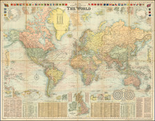
A Grand Map of the World At The Height of the British Empire
Decorative large format map of the world, showing the British Empire, at its height.
Around the map are inset details: with plans of towns including Hong Kong, Singapore, Sydney and New York; the Panama and Suez Canals; the British Isles; the two Poles; and a Universal Time Chart.
Along the top are a selection of national flags and ensigns; along the bottom are Gazetteers and a list of Principal British Steamship lines.
We date the map based upon the table of discoveries at the bottom right, which shows discoveries up to 1906 (Peary' explorations in the Arctic).
Condition Description
Color-printed world map dissected in 24 sections and mounted on contemporary linen. Mounted in original red cloth case, gilt-lettered "Bacon's New Chart of the World Mercators Projection". Manuscript note "To Lieut Stuart Hutchinson RNR from his Affectionate Grandpa Hammer 1932"
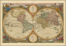
![[Early Facsimile] Novissima ac Exactissima Totius Orbis Terrarum Descriptio Magna cura & industrial ex optimist quibusq[uae] tabulis Geographicis et Hydrographicis nuperrimisq[uae] doctorum virorum observationib. duobus planisphaerijs delineata Auct. J. Hondio.](https://storage.googleapis.com/raremaps/img/small/69822.jpg)
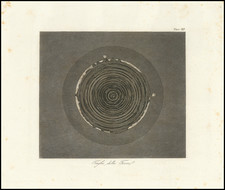
![Apollo Earth Orbit Chart (AEO) Apollo Mission 8. Sheet 1 of 3, Contains Revolution 1. For December 1968 Launch Dates [with:] Sheet 2 of 3, Contains Revolution 2. For December 1968 Launch Dates [and: Sheet 3 of 3, Contains Revolution 3. For December 1968 Launch Dates]](https://storage.googleapis.com/raremaps/img/small/95707.jpg)
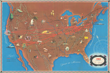
![The Western Hemisphere... [with:] The Eastern Hemisphere A Stereographical Projection on the Twentieth Meridian](https://storage.googleapis.com/raremaps/img/small/97573.jpg)