All of our maps are authentic antique maps, printed or drawn on or about the date shown in the description. In rare instances when we offer facsimiles, we will specifically describe the map as a later facsimile and include the date of publication. Certificates of Authenticity are included with each item.
Map Maker
Fast, Global Shipping
Last year we shipped over 4,500 antique maps to more than 50 countries. Maps are shipped Monday through Friday year-round. If an order is received before 2 PM PST, we will ship the order that day. If an order is received after that time, we will ship the next day. We ship maps either flat in custom packages or in specially ordered thick tubes. Shipping rates are provided as part of the checkout process.
Description
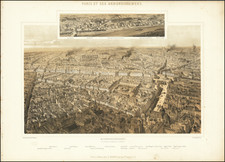
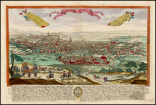
Large view of Paris and its suburbs, published in Paris in 1760.
The map includes a list of its parishes, flanked by 2 text panels, which includes a description of the French capital.


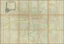
![[Paris] Nouvelle Carte Routiere du Voyageur aux Environs de Paris Contenant: les Departemens de la Seine, de Seine et Oise et partie ceux adjacens; La Seule Ornee des Vues principaux Monumens qui s'y trouvent situes depose 1830](https://storage.googleapis.com/raremaps/img/small/62632.jpg)