![[Revolutionary War Plans of New York, Boston, Charleston, Delaware River to Philadelphia & Havana] Various Plans and Draughts of Cities, Towns, Harbours &c . . . By Thomas Conder](https://storage.googleapis.com/raremaps/img/small/83450.jpg)


|
||

|

|
|

|
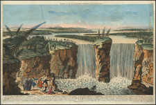
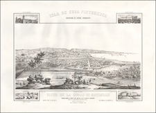
Fascinating set of American Revolutionary War era plans of the major harbors in the Theater of War.
Engraved by Thomas Conder, the present set of plans illustrates the major American ports which were vital during the conflict. The engravings, based on larger printed plans by the celebrated British mapmaker William Faden, depict five battle plans for New York Harbor and Island, the Boston Harbor region, Charleston, the Delaware River from Chester to Philadelphia, and Havana. These plans offered popular readers in England visual guides for the major American ports of the Revolutionary War era.
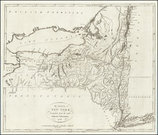
New York and Surrounding Regions
Far from focusing solely on the city of New York, the engraving encompasses Long Island, Staten Island, and contiguous parts of New Jersey. The depiction of these strategic lands captures the full scope multifaceted campaign, portraying not only the city but the surrounding regions.
The Boston Harbor Region
The Boston section of the engraving expands beyond the city to cover the wider Boston Harbor region, extending south to Dorchester and north to Hog Island, Shirley Island, and Deer Island. These areas were of strategic importance during the war, and their inclusion in the engraving emphasizes the broad scope of the conflict. The portrayal of these islands and the harbor reflects a multifaceted understanding of the naval and land strategies employed in the Boston area.
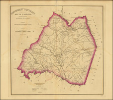
Charleston and Its Environs
In a similar vein, the Charleston section of the engraving extends to cover key surrounding locations such as Sullivan Island, James Island, Johnston's Fort, Coffin Land, and more. This wider view of Charleston provides a rich perspective on the warfare that unfolded in the Southern stronghold. The inclusion of these neighboring lands offers a visual narrative that brings to life the extensive network of fortifications and strategic locations that were pivotal to the war in the South.
Delaware River: Chester to Philadelphia
The portrayal of the Delaware River is equally comprehensive, extending from Chester to Philadelphia and covering the opposing Jersey shore. Notable details like the Tinicum Channel and Ship Channel on either side of the various islands in the River are included, providing a panoramic view of this strategic corridor. The engraving’s focus on this vital line for supplies, communication, underscoring its significance during the Revolutionary War.
Havana
The Havana section continues to emphasize the global scope of the conflict, reflecting the significance of the Caribbean territories. It acts as a reminder of the broader imperial struggles that transcended mainland North America, highlighting the complex geopolitical landscape of the era.