|
||

|

|
|

|
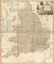
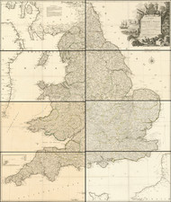
Stock# 87857
Description
Antique physical map of England and Wales, with the different natural watersheds outlined in color, as well as showing relief shown by hachures, rivers, cities, etc.
Letts continued the publication of the Society for the Diffusion of Useful Knowledge into the 1870s.
Condition Description
Minor foxing. Original hand-color.