|
||

|

|
|

|
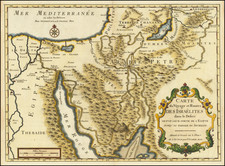
Arrowsmith's Upper Egypt with Inset Showing Explorations of Legh and Smelt
Rare second state of Aaron Arrowsmiths separately published map of Upper Egypt, first issued (without the inset map) on November 20, 1807.
This is the second state of the map, which adds a large inset map of the "River Nile, From the Cataracts to Ibrim, by Thomas Legh Esqr. M.P. & the Revd. Charles Smelt A.D. 1813." The inset is based upon the account of Thomas Legh's travels in Egypt between 1812 and 1813, which was published as Narrative Of A Journey In Egypt And The Country Beyond The Cataracts in 1816. Legh travelled in Egypt with Rev. Charles Smelt, whose journal Legh used in this narrativee. Exploring above Aswan, they reached as far as Nubia, where they were among the first modern explorers to examine the temples.
The map extends from Cairo and Suez in the north to the Assouan area and includes a text block describing the Roads, Navigation of the Nile River, and discussion of Egypt's Canals. While largely focused on the area around the river, the map shows important roads, springs, topography and the hydrographical features of the "Sea of Suez."
The overland route of "Mr. Irwin" in September 1777 is shown, showing the route taken by the Irish poet Eyles Irwin and later popularized in his A Series Of Adventures In the Course Of a Voyage Up the Red-Sea, On the Coasts Of Arabia and Egypt, published in 1780. A table at the right shows the distances From Cossier Fort Gate to Ghinnah, with information on the major wells along the route.
Rarity
The map is apparently very rare, especially this second state.
RBH locates 1 example at auction in the past 50 years (1807 edition). AMPR lists 2 examples of the 1807 edition offered by Jonathan Potter in the past 30 years (1996 and 2000). The last example of the 1816 edition in RBH was offered by Francis Edwards in 1973.
OCLC locates a single example of the 1816 edition in the British Library.
The Arrowsmiths were a cartographic dynasty which operated from the late-eighteenth century to the mid-nineteenth. The family business was founded by Aaron Arrowsmith (1750-1823), who was renowned for carefully prepared and meticulously updated maps, globes, and charts. He created many maps that covered multiple sheets and which were massive in total size. His spare yet exacting style was recognized around the world and mapmakers from other countries, especially the young country of the United States, sought his maps and charts as exemplars for their own work.
Aaron Arrowsmith was born in County Durham in 1750. He came to London for work around 1770, where he found employment as a surveyor for the city’s mapmakers. By 1790, he had set up his own shop which specialized in general charts. Arrowsmith had five premises in his career, most of which were located on or near Soho Square, a neighborhood the led him to rub shoulders with the likes of Joseph Banks, the naturalist, and Matthew Flinders, the hydrographer.
Through his business ties and employment at the Hydrographic Office, Arrowsmith made other important relationships with Alexander Dalrymple, the Hudson’s Bay Company, and others entities. In 1810 he became Hydrographer to the Prince of Wales and, in 1820, Hydrographer to the King.
Aaron Arrowsmith died in 1823, whereby the business and title of Hydrographer to the King passed to his sons, Aaron and Samuel, and, later, his nephew, John. Aaron Jr. (1802-1854) was a founder member of the Royal Geographical Society (RGS) and left the family business in 1832; instead, he enrolled at Oxford to study to become a minister. Samuel (1805-1839) joined Aaron as a partner in the business and they traded together until Aaron left for the ministry. Samuel died at age 34 in 1839; his brother presided over his funeral. The remaining stock and copper plates were bought at auction by John Arrowsmith, their cousin.
John (1790-1873) operated his own independent business after his uncle, Aaron Arrowsmith Sr., died. After 1839, John moved into the Soho premises of his uncle and cousins. John enjoyed considerable recognition in the geography and exploration community. Like Aaron Jr., John was a founder member of the RGS and would serve as its unofficial cartographer for 43 years. Several geographical features in Australia and Canada are named after him. He carried the title Hydrographer to Queen Victoria. He died in 1873 and the majority of his stock was eventually bought by Edward Stanford, who co-founded Stanford’s map shop, which is still open in Covent Garden, London today.
![Barbaria [with] Cartaginis sive potius Tunetani celeberrimi Sinus nec non fortalitij . . . [with] [Untitled map of Egypt]](https://storage.googleapis.com/raremaps/img/small/72788.jpg)
![Egypt and Barca [with] Abissina and Nubia [with] Congo. Angola. Cafres. Monoemugi. Monomotapa. Zanguebar & Madagascar](https://storage.googleapis.com/raremaps/img/small/78890.jpg)