The item illustrated and described below is sold, but we
have another example in stock. To view the example which
is currently being offered for sale, click the
"View Details" button below.


|
||

|

|
|

|
Stock# 8313
Description
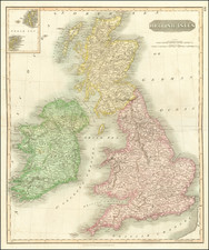
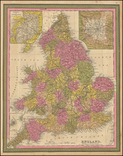
Detailed map of England, colored by the various provinces. Shows towns, roads, rivers, mountains, islands, etc. Large inset of environs of London and Liverpool. This map is from the first edition of Thomas Cowperthwait's New Universal Atlas. The Atlas would become the most popular American Atlas, published annually, first by Tanner and later by Mitchell, Cowperthwait, and DeSilver.