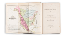
|
||

|

|
|

|
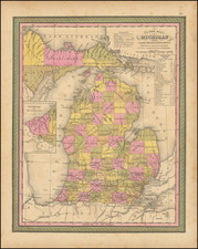
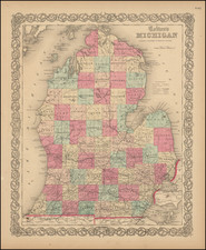
Early and large-scale geological map of Michigan showing the state in full with its strata of various ages.
This scarce map shows the state in exquisite and extensive detail. Cities, towns, and more are named throughout. Waterways and important geographical features are noted.
The focus of the map is on the state's geology, for which some over thirty types of strata are delimited and colored. These strata are also given lengthy lithological descriptions. The structure of the state's geology, in which the Lower Peninsula is covered by mostly low-dipping younger deposits overlain by drift deposits while the Upper Peninsula has older, more steeply dipping units.
This map was published in 1916 by R. C. Allen, R. A. Smith, and L. P. Barrett, from the Geological Survey of Michigan. Allen was an important geologist who took over as head of the Michigan Geological Survey in 1909. He specialized in studying the extensive Cambrian and pre-Cambrian deposits that are widely exposed in Michigan's Upper Peninsula, as part of the North American craton.