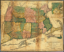
![Rhode Island [with Block Island] By Thomas Gamaliel Bradford](https://storage.googleapis.com/raremaps/img/small/101077.jpg)


|
||

|

|
|

|
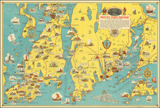
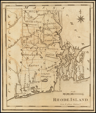
Fine example of Bradford's large format map of Rhode Island, first published in 1838.
The map is hand colored by town and showing towns, counties, islands, roads, lakes, rivers, etc.
Nice large example of Block Island, which rarely appears. The Stonington Railroad is shown, a very early appearance for a railroad line. The town known today as Pascoag is labeled "Monkey Town", a name of unknown origin but several theories, including one involving a sailor bringing a crowd-pulling monkey back to Rhode Island.
Thomas Gamaliel Bradford (1802-1887) was an American geographic publisher. He hailed from Bradford, Massachusetts and began his publishing career by working for the America Encyclopedia. Then, he edited and republished the Atlas Designed to Illustrate the Abridgement of Universal Geography, Modern & Ancient, which had originally been offered in French by Adrian Balbi. In 1835, he published another atlas, A Comprehensive Atlas: Geographical, Historical & Commercial, and, in 1838, An Illustrated Atlas Geographical, Statistical and Historical of the United States and Adjacent Countries. His interests were primarily in educational publishing and he was one of the first mapmakers to show Texas as an independent country.