|
||

|

|
|

|
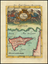
Rare Ancient Map of Cyprus
First state of this rare 18th Century map of Cyprus, published by Pierre Moullart-Sanson, illustrating the ancient place names of Cyprus.
This is one of the rarest and most unusual maps of Cyprus, focused on the place names of Cyprus as known to the Ancients. The map shows the island with ancient placenames, from prior to the 12th Century.
The nine Cypriot kingdoms are shown, Amathus, Chytroi, Kition, Kourion, Lapethos, Marion, Paphos, Salamis, and Soloi. The map is drawn from various historical sources from antiquity, including Herodotus' Histories and the works of Diodorus the Sicilian. Moullart-Sanson also used information drawn from two ancient cartographers, Ptolemy and Strabo. In the middle of the 4th century, the kingdoms of Cyprus are usually listed as ten, including Marium, Tamassus, and Kerynia, which Moullart-Sanson omits and adds Chytri and Mali instead.
His Roman roads connecting the main towns as borrowed from the Tabula Peutingeriana are also modified.
The rest of the contents of the map are worth studying in detail. They are mainly based on Strabo and Ptolemy, but there are also some original suggestions by Moullart-Sanson himself. For example, he marks the ancient city of Asine in the kingdom of Soli, which is correct. However, other cartographers keep it as of unknown position on their "ancient" maps (Ortelius and others), although it is marked as a village in the corrupted form of Asimion their ordinary maps.
Moullart-Sanson also adapted the Ptolemaic latitude and longitude to his map. (Stylianou)
This is the first map of Cyprus by Pierre Moullart-Sanson, grandson of France's most famous 17th Century mapmaker, Nicolas Sanson. Moullart-Sanson’s second map of Cyprus, published in 1720 shows both administrative divisions and placenames which date back to medieval times, specifically, the period from the 12th Century to 1570, during which time Cyprus was a Frankish-Latin Kingdom and later a Venetian Colony (1489-1570).
Both of Sanson-Moullart's maps are based upon the outlines and geographical features of a 1570 map drawn by Venetian mapmaker Paolo Forlani.
The history of these two maps has been much studied. It has been observed that there are no surviving atlases which contain both maps. Several commentators have opined that the maps may have been intended for inclusion in book on the history of Cyprus that was never published.
Rarity
The map is extremely rare on the market.
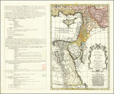
![[Cyprus, Holy Land, Syria Middle East] Tabula Asiae IIII](https://storage.googleapis.com/raremaps/img/small/100937.jpg)
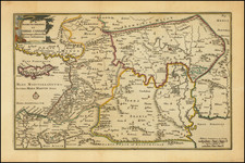
![[ Turkey / Asia Minor / Cyprus ] Natolia, quae olim Asia Minor](https://storage.googleapis.com/raremaps/img/small/71805.jpg)