This item has been sold, but you can enter your email address to be notified if another example becomes available.


|
||

|

|
|

|
Stock# 8089
Description
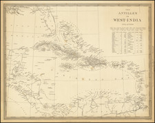
Rare map of the North Sea (Atlantic Ocean) from the Polar Circle to the Equator, showing much of North America, the Caribbean, and parts of Europe and Africa. The map title matches a much smaller map issued in George Bickham's British Monarchy c.1740, but this map is substantially larger. The detail in the British Colonies in North America includes Carolina, Virginia, Maryland, Pennsylvania, New Yrok and New England. Very curious projection of Florida. Bermuda is shown. The various British Family Dukedoms in Europe are noted, as are certain strategic places on the Gold Coast in Africa and elsewhere. A rare and fascinating map. Narrow upper margin.
![Colton's West Indies [Bermuda and Havana insets]](https://storage.googleapis.com/raremaps/img/small/71868.jpg)