|
||

|

|
|

|
Stock# 80531
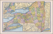
Description
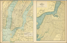
Detailed mid-19th Century New York City plan, from the Society for the Diffusion of Useful Knowledge (SDUK).
Extends north to around 40th Street and includes parts of Brooklyn, Williamsburgh, Jersey City and Governor's Island. The Harlem Railroad is shown extending into the Bowery, as are the Albany, Long Island, New York and Williamsburgh Ferries. The Proposed Pier & Basin is shown in the Hudson River, as are the ship yards, dry docks and other features in the East River.
Large vignette of City Hall and Broadway from the Park. 40 public buildings are named in the key of the map.