|
||

|

|
|

|
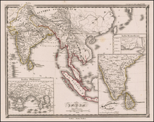
Fascinating map of southern India published in London by John Luffman in his Select Plans showing the recent territorial gains made in India by the English and allied groups. Stretching from Sri Lanka to the mouth of the Krishna River, this map shows lands ceded by Tipu Sultan, leader of the Kingdom of Mysore, in the state's border regions. This followed the Third Anglo-Mysore War, and Tipu would be killed during the Fourth Anglo-Mysore War in the year this map was engraved.
Luffman's Select Plans is an uncommon traveler's guide that served to educate the intrepid traveler regarding any part of the world, from the major cities of Europe to the wild coasts of the Spice Islands. Each of Luffman's maps contained detailed coastal descriptions showing the major landmarks and cities, as well as basic but necessary navigational information. This plate appeared in the first of Luffman's two volumes.
![[India] Tabula Asiae X](https://storage.googleapis.com/raremaps/img/small/89683.jpg)
![[Trekking in the Himalayas]](https://storage.googleapis.com/raremaps/img/small/43997.jpg)
![[ Kashmir ] Vacances au Cachemire](https://storage.googleapis.com/raremaps/img/small/80937.jpg)