|
||

|

|
|

|
This PT Barrow Aeronautical Chart is a detailed representation of the aviation landscape around Point Barrow, Alaska, the northernmost point of the United States, as of August 1941. Compiled and printed by the U.S. Coast and Geodetic Survey under the direction of L.O. Colbert, the chart combines information from the U.S. Geological Survey, U.S. Coast and Geodetic Survey, and other sources to offer a comprehensive navigation tool for aeronautical use.
As an aviation map, the chart excels in its precision, laying out numerous crucial features of air navigation. It demarcates army, navy, or marine corps fields, commercial or municipal airports, and marked auxiliary fields, including specific notations for emergency use by civil aircraft. Furthermore, the chart accommodates marine elements into the aviation framework by denoting seaplane bases, seaplane anchorages with varying facilities, marine navigational lights, and marine radiobeacons, highlighting the coastal significance of the area.
Key features of the chart include a spectrum of terrestrial infrastructures like railroads, gravel roads, dirt roads, and trails. It also presents sophisticated navigation aids such as radio stations and radio direction finder stations, each marked with respective call letters and frequencies, underscoring the importance of radio communication in 1940s aviation. The chart meticulously indicates obstructions, with numerals to denote their height above ground in feet, and lines of equal magnetic variation, reflecting the complex interplay of geographic, magnetic, and man-made elements in aeronautical navigation.
Notably, the PT Barrow Aeronautical Chart explicitly mentions that it is subject to updates from "Weekly Notices to Airmen," underscoring the dynamic nature of the aviation landscape. This combination of static geographical information with the capacity for regular updates mirrors the rapidly evolving aviation technology of the period.
In sum, the PT Barrow Aeronautical Chart offers a meticulous snapshot of the aviation landscape in the northernmost point of the United States in the early 1940s, making it an invaluable resource for understanding the logistics of air navigation of the time.
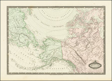
![[ Alaska / Russian America / Asia ] Partie Orientale du Gouvernement d'Ircoutski avec les Cotes et les Isles Septentrionales de L'Amerique](https://storage.googleapis.com/raremaps/img/small/105773.jpg)
![[St. Lawrence Island, Alaska] Карта Острова св: Лаврентия исправленная колониальными мореходами [Map of the Island of St. Lawrence corrected by the colonial sailors.]](https://storage.googleapis.com/raremaps/img/small/59917.jpg)
![[ California To Alaska -- Northwest Passage ] Quivirae Regnu cum alijs versus Borea](https://storage.googleapis.com/raremaps/img/small/60083.jpg)