|
||

|

|
|

|
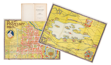
Rare 19th-Century Map Salesman's Canvassing Book
Collecting Subscribers for Unrealized Map of Greene County, Pennsylvania, with a Note Regarding Lloyd's Map of the United States
A most unusual and rare survival, an original manuscript canvassing book for an unrealized map by prolific mapmaker Simon J. Martenet. The notebook contains the names of subscribers who promised to pay $5 for a planned Map of Greene County, Pennsylvania. The proposed map is described herein as "very large and complete" and was to measure between three and four feet square. It was not uncommon for maps and atlases to be sold in 19th century America by traveling door-to-door canvassers, who would collect names of customers who promised to purchase a map or atlas, usually paying for the item upon delivery.
Simon J. Martenet was a prolific mapmaker who completed several Maryland maps during his career. We can not find a Greene County, PA, map by Martenet in any cartographic reference or online catalog. No such map is noted in OCLC.
The canvassing book contains a detailed description of the planned map project:
The undersigned is about to publish, if a sufficient number of subscribers can be obtained, a map of Greene County of the following description.
The map will be very large and complete, (between three and four feet square) showing distinctly marked and very accurately located, all the public roads, streams, towns, post offices, churches, mills, stores, taverns, and othe public places, with also the residence of property-holders with the names of the owners marked opposite; and the towns one a larger scale on the margin. The whole to be embellished (by views &c) as far as may be justified by the encouragement received in subscription. The drawing to pass an examination of a competent committee to be appointed by the County. The maps to be well executed, backed on muslin, colored in townships, varnished, and on rollers.
The price to be five dollars per copy - payable on delivery of the finished maps.
Simon J. Martenet, Surveyor & Civ. Eng.
Apparently, the thirty subscribers recorded in the book did not represent enough market interest to bring the map to fruition, as we can find no record of such a map in the usual carto-bibliographies.
Pennsylvania and Virginia Border
The time and place of the proposed Greene County map is worth noting: Greene County is in southwestern Pennsylvania, near the border with present-day West Virginia, a region marked by a long history of border disputes. Greene County is in a region that was once claimed by Virginia as the District of West Augusta, a short-lived historical region of colonial Virginia that existed in 1774-1776. The region encompassed part of northern West Virginia and southwestern Pennsylvania.
Then in 1861, residents of what is now western and northern West Virginia set up a separate government under Francis Pierpont, called the Restored Government. The new state of West Virginia was admitted to the Union in 1863.
The Map Seller
The first name listed in the list of subscribers is D. W. Kennedy of Waynesburg, who was very likely the map seller himself. His penciled name also appears next to Simon Martenet's name in the above transcribed description of the map. In addition, there is an additional sales proposition for another map in the booklet:
D. W. Kennedy, Sir, Please send me one of Lloyd's New maps of the United States, the Canadas & New Brunswick, from the latest surveys showing every Railroad & Station finished to June 1863 and colored in Countys, Varnished and on Rollers and I will pay you the Sum of One Dollar and twenty five cents on delivery. March 1864.
A selection of the names recorded in the subscriber list here follows.
- H. Reagan, Rogersville
- J. J. Williams, Rogersville
- John J. Huss, Waynesburg
- Geo. F. Wolfe, Waynesburg
- Silas Hedge, Franklin
- Jeremiah Stewart, Green
- James Bell, Morgan
- Morgan S. Dunn, Washington
- William A. Porter, Waynesburg
- Amos Smith, Morgan
- Samuel Fulton, Morgan
- Jacob Greenlee, Morgan
A rare and historical artifact that sheds light on the production and marketing of maps in mid-19th-century America.
Rarity
Such manuscript canvassing books used by 19th-century American mapsellers are extremely rare; this is the first we have encountered.
![[ Atlas - Florida and Southern Canal Projects ] Travaux d'améliorations intérieurs projetés ou exécutés par le gouvernement général des États-Unis d'Amérique, de 1824 à 1831 [complete with:] Travaux d'améliorations intérieurs projetés ou exécutés... Atlas.](https://storage.googleapis.com/raremaps/img/small/85067.jpg)
![[ New France - Pierre Biard's Letter ] Missio Canadensis [in] Annuæ Litteræ Societatis Jesu Anni MDC.XI.](https://storage.googleapis.com/raremaps/img/small/84352.jpg)