
The First Atlas Devoted Entirely to the Americas. Including the First Printed Map Devoted to California, the Most Accurate Map of the East Coast to Date, and the First Map to use "Canada" in its Title (Burden).
"[A]s important in the history of the early cartography of the new world, as Ptolemy's maps are in the study of the old" (Phillips).
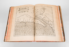
Handsome example of the first atlas devoted entirely to the Americas, compiled by Cornelius Wytfliet.
Wytfliet's atlas was intended as an addition to Ptolemy, meant to augment the complete geography of the old world with a complete geography of the new. The maps in the volume are astounding, and include remarkable maps of the entirety of the Americas. Particularly notable are the maps of California, Virginia, New France, and the North Atlantic.
Cornelius Wytfliet was a Dutch cartographer who was one of the many learned humanists operating in the universities of Northern Europe around that time. Little is known about his life today, but he is best remembered for his atlas of the Americas, his Descriptionis Ptolemaicae Augmentum, first published in 1597.
Wytfliet's work is a must for any serious collector of Americana.
Notable Maps
Granata Nova Et California
This is the first printed map devoted to California and the Southwestern U.S. One of the map's most interesting features is the depiction of many of the fabled mythical places in the region, including the 7 cities of Cibola ( Septme ciuitaum Patria), shown around a lake, out of which flows a river which empties into the Gulf of California. The map is largely based upon Plancius' world map of 1592. This is a seminal map for collectors of California and the Southwest.
Norumbega et Virginia
This is one of the earliest printed maps of the East Coast of the United States. Wytfliet's map is a highly important record of European knowledge of the region immediately before the English voyages of discovery and settlement in Virginia and New England and Champlain's French expeditions to eastern Canada. Wytfliet's map is the most accurate depiction of the region prior to Joannes de Laet's map, Nova Anglia, Novvm Belgivm Et Virginia (1630).
Chica Sive Patagonica et Australis Terra.
This is the first separate map to focus so minutely on the South Pole and its environs. This single sheet is split into two sections, with a map of the Straits of Magellan and a hemispheric projection of Terra Australis. In the Australian section of Terra Australis, the coastline is given an undulating form, hinting at some of the potential half-discoveries of Portuguese and other sailors. This map probably represents a reprojection of information from Plancius (e.g. his 1592 world map) whose work was the source for most of Wytfliet's other maps.
Limes Occidentis Quivira et Anian.
This is the second printed map to focus on the region which would become Alaska and the Pacific Northwest. The map shows the coast from Northern California to a mythical Northwest Passage in the Arctic Circle, based upon Mercator's large world map of 1569. It shows an area similar to De Jode's Quivirae Regnu of 1593, the first printed map to focus on the area. The nomenclature is from Plancius' World map of 1592.
Provenance
Inscription "Ad usum f Augustini Dijsembart 1641" on title.
Collation
[8]; 1-92; [engraved map]; 93-100; [engraved map]; 101-114; [engraved map]; 115-118; [engraved map]; 119-120; [engraved map]; 121-126; [engraved map]; 127-136; [engraved map]; 137-140; [engraved map]; 141-144; [engraved map]; 145-150; [engraved map]; 151-154; [engraved map]; 155-160; [engraved map]; 161-166; [engraved map]; 167-170; [engraved map]; 171-174; [engraved map]; 175-176; [engraved map]; 177-182; [engraved map]; 183-184; [engraved map]; 183-188; [engraved map]; 189-191; [1].
Cornelius de Wytfliet (ca.1550-ca. 1597) was a Flemish cartographer most famous for his Descriptionis Ptolemaicae Augmentum. The work was published in Louvain, Belgium, and had nineteen maps of the Americas.