|
||

|

|
|

|
Scarce separately issued Spanish Sea chart of the Gulf of Mexico, published by the Spanish Hydrographical Department.
The map extends from the mouth of the Rio Grande River in the southwest to the Florida Panhandle.
Highly detailed, including soundings and lighthouses.
The map includes the following inset charts:
- Plano de la Pasa del Caballo y entrada a la bahia de Matagorda por el Comodoro Moore de los Estados Unidos en 1841.
- Plano de la Bahia de Galveston for el teniente Craven de la marina de los Estados Unidos en 1851.
- Plano de la boca del rio Sabina por los capitanes Lee y Pillans de la marina de los Estados Unidos en 1840.
- Plano de la Bahia de Biloxi
- Plano del Puerto de San Luis.
Embossed with the stamp of the Direccion de Hidrografia in Madrid at the lower left.
Rarity
First edition. One copy located in OCLC, at the British Library.
The Dirección de Hidrografía, or the Directorate of Hydrographic Works, was established in 1797. Its roots were in the Casa de Contratación, founded in 1503 in Sevilla, which housed all the charts of the Spanish Empire and oversaw the creation and maintenance of the padrón real, the official master chart. The Casa, now in Cadiz, was shuttered in 1790, but Spain still needed a hydrographic body. In response, the Dirección was created in 1797. One of its first projects was the publication of charts from the Malaspina Expedition (1789-1794). The Dirección oversaw not only publication, but also surveying. The Dirección was abolished in the early twentieth century, when their work was distributed to other organizations.

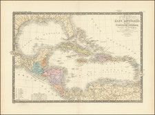
![[ Republic of Texas ] Central America II. Including Texas, California and the Northern States of Mexico](https://storage.googleapis.com/raremaps/img/small/93534.jpg)
![[ Florida ]](https://storage.googleapis.com/raremaps/img/small/103085.jpg)