|
||

|

|
|

|
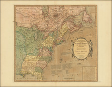
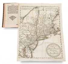
Laurie's map of Fredonia is one of the scarcest and most interesting maps of the post Lewis & Clark era.
First issued in 1830, Rumsey notes that the map is the only map to directly incorporate information from each of the major source maps of the period, the 1814 Lewis & Clark, 1822 Long and the 1810 Arrowsmith Mexico.
Fredonia was the named coined by Senator Samuel L. Mitchell as an alternative name for the United States. The name was given some significant consideration during the early 19th Century. Rumsey notes that Laurie borrowed the name Fredonia, along with the name Cabotia for Canada, as a marketing novelty for the two maps.
The Fredonia map was updated in 1832, 1833, 1834, 1836 and 1849. The changes in the latter editions are of significant note, as Laurie has incorporated important new information from Arrowsmith's map of British North America in 1834, especially in California and Texas. Austins Town is noted in Texas and there are numerous other early notes, annotations and geographical information.
While most editions of the map reflect some attribution to G.F. Cruchley, who was the primary distributor of the map, the map and slip case for this example are notably free of any pastedowns or other reference to Cruchley. The map is rich with marvelous detail, far beyond the limitations of this description.
Richard Holmes Laurie (1777-1858) was the son of mezzotint engraver Robert Laurie, who had taken over Robert Sayer's publishing house with James Whittle in 1794. Richard Holmes Laurie joined in a partnership with Whittle when his father retired in 1812. The name of the firm then switched from Laurie & Whittle to Whittle & Laurie. Whittle died in 1818, leaving Richard Holmes to continue publishing alone as R. H. Laurie.
When the Hydrographic Office opened in 1795, it was tasked with creating and producing all the nautical charts for the Royal Navy so as to wean the Navy off dependence on foreign charts. By the 1820s, private publishers were augmenting HO charts and competing with them, including Richard Holmes Laurie. Richard gave up publishing anything except nautical materials by 1830. He also sold charts to Trinity House, the lighthouse and maritime safety fraternity. He died in 1858.
The firm continued to print under the name R.H. Laurie even after 1858. Later, the firm was managed by Laurie’s draughtsman, Alexander George Findlay, and, later, Daniel and William Kettle.
![[An English Propaganda Map In French] Carte Des Possessions Angloises & Francoises Du Continent De L'Amerique Septentrionale 1755.](https://storage.googleapis.com/raremaps/img/small/86975.jpg)