This item has been sold, but you can enter your email address to be notified if another example becomes available.


|
||

|

|
|

|
Stock# 71719
Description
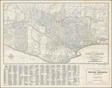
The First Atlas Map of Oceanside, California
The map provides a fine town plan of Oceanside, California.
The map shows Oceanside's Pier (constructed in 1888), as well as the rail line and depot of the Atchison Topeka & Santa Fe Railroad. A number of the earliest subdivisions are shown and named.
This is from W.E. Alexander's 1912 Plat Book of San Diego County, California published by the Pacific Plat Book Company of Los Angeles and San Francisco.
Rarity
In over 25 years of business in San Diego, this is the first time we have offered the map for sale.
Antiquarian maps of Oceanside, California are essentially unobtainable.
![[Stockton] Map of the Property of the Stockton City Homestead Association, Surveyed February 1869](https://storage.googleapis.com/raremaps/img/small/83391.jpg)
![[La Jolla Farms / Scripps Institute of Oceanography] Referee's Partition Map of Pueblo Lots 1312 and 1313 of the City of San Diego, California, as made in accordance with an order from the Superior Court of San Diego County California, made in the action entitled Winnifred Murtha et al vs. Louis D. Radgesky, et al. . . .](https://storage.googleapis.com/raremaps/img/small/77020.jpg)