|
||

|

|
|

|
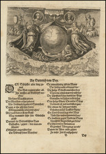
The Zeno Brothers Discoveries in the North Atlantic in the 14th Century
Fine dark impression of this fine large format example of Nicolo Zeno's map of the North Atlantic, based upon the legend of a 14th Century Venetian family and their reported travels to the New World, which flourished as a factual account and was incorporated into a number of maps in the second half of the 16th Century.
The first modern description of the Zeno family travels in the new world appeared in a 1558 travel book describing a pre-Columbian voyage to the New World in 1380 by Venetians Nicolo and Antonio Zeno. The map was later copied in 1561 by Ruscelli in his edition Claudius Ptolemy's Geographia, which introduced the map and legend to a significantly broader audience. Notably, Ruscelli revised the original 1558 map, which showed a continuous coastline from Norway to Greenland. Ruscelli in turn showed Greenland separate from Scandinavia, with a large sea separating the two land masses.
This edition of the map, issued in Nouvelles des Voyages er des Sciences Geographiques, published by J.B. Eyries and Conrad Malte-Brun, faithfully reproduces the original map and incorporates an inset map showing full journey of the Zeno brothers reaching across the Atlantic to Canada.
Most historians regard the map and accompanying narrative as a hoax, perpetrated by the younger Zeno to make a retroactive claim for Venice as having discovered the New World before Christopher Columbus. The evidence against the authenticity of the map is based largely on the appearance of many non-existent islands in the North Atlantic and off the coast of Iceland. One of these non-existent islands was Frisland, where the Zeno brothers allegedly spent some time.
In addition to propagating the myth of the Zeno voyage, the map depicted many of the fictitious islands of the Atlantic in remarkable detail, including Frisland (with 32 places named), Deogeo, Estotiland, Estland, and the monastery of S. Tomas in Greenland.
Many of these mythical islands and places were depicted on maps for centuries, mainly because Gerard Mercator accepted the account of Zeno's voyage as authentic and adopted much of it in his famous large 1569 world map and his 1595 map of the North Pole. Ortelius in turn used the map as a prototype for his map of the North Atlantic. Frobisher and Davis accepted the map for their explorations in the 1570's and 1580's, respectively. Nice example of the first state of this historically important map.
The Zeno brothers, Nicolo (1326-1402) and Antonio, (d. 1403) were noted Italian navigators from Venice, who flourished in the second half of the 14th century. They were brothers of the Venetian naval hero Carlo Zeno. The Zeno family was an established part of the aristocracy of Venice and held the franchise for transportation between Venice and the Holy Land during the Crusades.
The Zeno map of the North Atlantic first published in 1558 in Venice by Nicolo Zeno, a descendant of Nicolo Zeno, of the Zeno brothers. Zeno published the map, along with a series of letters, claiming he had discovered them in a storeroom in his family's home in Venice.
The letters are divided into two parts. The first letters (from Nicolo to Antonio) tell how Nicolo set off in 1380 on a voyage from Venice to England and Flanders. Evidence exists that such a voyage took place, and that Nicolò returned to Venice around 1385. In the letters, Nicolò describes being stranded on an island between Great Britain and Iceland called Frislanda, which is described as being larger in size than Ireland. Nicolo is rescued by Zichmni, who is described as prince who owned some islands called Porlanda off the southern coast of Frislanda, and who ruled the duchy of Sorant, or Sorand, south-east of Frislanda.
Nicolo invites Antonio to come to Frislanda and the pair remain for fourteen years. Under Zichmni's direction, Antonio attacks "Estlanda", (perhaps the Shetland Islands), as indicated by the similarity of place names mentioned in the letters. Zichmni then attempts to attack Iceland. After finding it well defended, he attacks seven islands along its eastern side: Bres, Talas, Broas, Iscant, Trans, Mimant, Damberc. All of these islands are fictitious. Zichmni then builds a fort on Bres and leaves Nicolo in charge of it. Nicolo makes a voyage to Greenland and finds a monastery with central heating. He then returns to Frislanda, where he dies, having been in the north for four or five years.
After Nicolo's death, Zichmni receives word that a group of lost fisherman from Frislanda have returned after an absence of over 25 years. The fisherman describe having made landfall in the far west in unknown countries called Estotiland and Drogeo. The fishermen describe having encountered strange animals as well as cannibals, from whom they escaped only after teaching the cannibals how to fish. Inspired by the tales of the fishermen, Zichmni undertakes a voyage to the west with Antonio in charge of his fleet. To the west of Frislanda, they encounter a large (mythical) island called Icaria.
According to the letters, the inhabitants of Icaria greet them before they can make landfall. Only one person among the Icarians is able to speak a language that Zichmni understands. The inhabitants state that visitors to the island are not welcome and that they will defend the island to the last man if need be. Zichmni sails along the island looking for a place to make landfall, but the inhabitants chase him and Zichmni abandons the effort. Sailing west, they make landfall at a promontory called Trin on the southern tip of "Engrouelanda". Zichmni likes the climate and the soil, but his crew find it inhospitable. The sailors return home with Antonio, while Zichmni stays on to explore the area and build a town.
The present example of the map was published at the conclusion of a period in which the Zeno legend was again in currency. The map was originally used by early English explorers in search of the Northwest Passage. Thereafter story remained dormant for about a hundred years until it was revived by Forster and Buache in the late 18th century. The Hakluyt Society published an English translation in 1873 and in 1883 Baron Nordenskiöld argued in favor of the validity of the narrative. Finally in 1898, Frederick Lucas concluded that it was a hoax after an extensive study in which he identified its main source to be Olaus Magnus' Carta marina, along with other 15th and 16th century maps.
Since that time, the legend has been the subject of additional intrigue and debate, with more than one scholar strongly advocating in favor of the Zeno story.
This 19th Century example of the map is extremely rare on the market. We know of only 1 example of the map which has changed hands in the past 25 years.
The Zeno Map and the mythical island of Frisland
The Zeno family was part of the Venetian elite; indeed, their family had controlled the monopoly over transport between Venice and the Holy Land during the Crusades. Nicolo Zeno set off in 1380 to England and Flanders; other evidence seems to corroborate this part of the voyage. Then, his ship was caught in a huge storm, blowing him off course and depositing him in the far North Atlantic. He and his crew were wrecked on a foreign shore, the island of Frislanda (sometimes Friesland or Freeland).
Thankfully, the shipwrecked Venetians were found by King of Frisland, Zichmni, who also ruled Porlanda, an island just south of Frisland. Zichmni was on a crusade to conquer his neighbors and Nicolo was happy to help him strategize. Nicolo wrote to his brother, Antonio, encouraging him to join him and, good navigator that he was, Antonio sailed for Frisland and arrived to help his brothers. Together, they led military campaigns against Zichmni’s enemies for fourteen years.
Their fights led the brothers to the surrounding islands, presumably enabling them to make their famous map. Zichmni attempted to take Islanda but was rebuffed. Instead, he took the small islands to the east, which are labeled on this map. Zichmni built a fort on one of the islands, Bres, and he gave command of this stronghold to Nicolo. The latter did not stay long, instead sailing to Greenland, where he came upon St. Thomas, a monastery in Greenland with central heating. Nicolo then returned to Frisland, where he died four years later, never to return to Venice.
Antonio, however, was still alive. He ran into a group of fishermen while on Frisland. These fishermen had been on a 25-year sojourn to Estotiland. Supposedly, Estotiland was a great civilization and Latin-speaking, while nearby Drogeo, to the south, was full of cannibals and beasts. Antonio, on Zichmni’s orders, sought these new lands, only to discover Icaria instead. The Icarians were not amenable to invasion, however, and Antonio led his men north to Engroneland, to the north. Zichmni was enthralled with this new place and explored inland. Antonio, however, returned to Frisland, abandoning the King. From there, Antonio sailed for his native Venice, where he died around 1403.
News of the discoveries and the first version of the Zeno map was published in 1558 by another Nicolo Zeno, a descendent of the navigator brothers. Nicolo the Younger published letters he had found in his family holdings, one from Nicolo to Antonio and another from Antonio to their other brother, Carlo, who served with distinction in the Venetian Navy. They were published under the title Dello Scoprimento dell’isole Frislanda, Eslanda, Engrouelanda, Estotilanda, & Icaria, fatto sotto il Polo Artico, da due Fratelli Zeni (On the Discovery of the Island of Frisland, Eslanda, Engroenland, Estotiland & Icaria, made by two Zen Brothers under the Arctic Pole) (Venice: Francesco Marcolini, 1558).
At the time of publication, the account attracted little to no suspicion; it was no more and no less fantastic than most other voyage and travel accounts of the time. Girolamo Ruscelli published a version of the Zeno map in 1561, only three years after it appeared in Zeno’s original work. Ruscelli was a Venetian publisher who also released an Italian translation of Ptolemy. Ruscelli had moved to Venice in 1549, where he became a prominent editor of travel writings and geography.
Ruscelli was not the only geographer to integrate the Zeno map into his work. Mercator used the map as a source for his 1569 world map and his later map of the North Pole. Ortelius used the Zeno islands in his map of the North Atlantic. Ramusio included them in his Delle Navigationo (1583), as did Hakluyt in his Divers Voyages (1582) and Principal Navigations (1600), and Purchas (with some reservation) in his Pilgrimes (1625). Frisland appeared on regional maps of the North Atlantic until the eighteenth century.
In the nineteenth century, when geography was popular as both a hobby and a scholarly discipline, the Zeno account and map came under scrutiny. Most famously, Frederick W. Lucas questioned the validity of the voyage in The Annals of the Voyages of the Brothers Nicolo and Antonio Zeno in the North Atlantic (1898). Lucas accused Nicolo the Younger of making the map up, using islands found on other maps and simply scattering them across the North Atlantic. He also accused Nicolo of trying to fabricate a Venetian claim to the New World that superseded the Genoan Columbus’ voyage. Other research has revealed that, when he was supposed to be fighting for Zichmni, Nicolo was in the service of Venice in Greece in the 1390s. He is known to have drafted a will in 1400 and died—in Venice, not Frisland—in 1402.
Scholars still enjoy trying to assign the Zeno islands to real geographic features. For example, Frisland is thought to be part of Iceland, while Esland is supposed to be the Shetlands. Some still believe the Zenos to have sailed to these lands. Most, however, view the voyage and the map as a reminder of the folly and fancy (and fun) of early travel literature and cartography. Whatever the truth, the Zeno map and its islands are one of the most enduring mysteries in the history of cartography.