This item has been sold, but you can enter your email address to be notified if another example becomes available.


|
||

|

|
|

|
Stock# 6870
Description
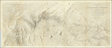
A nice uncolored example of the 2nd edition of the US Coast Survey's First mapping of San Diego, distinguished from the 1st edition by the addition of the official seal of the US Coast Survey in the left of the map. Covers the area from Point Loma and La Playa in the west to Shelter Island, with extensive soundings taken. Point Loma, Balast Point, La Playa, an Observatory, ship wreck and various buoys are noted. Larger inset diagram shows the entire bay. Extensive sailing notes in the upper left corner. One of the earliest obtainable maps of San Diego. Minor browning along one fold, as usual.