The item illustrated and described below is sold, but we
have another example in stock. To view the example which
is currently being offered for sale, click the
"View Details" button below.


|
||

|

|
|

|
Stock# 64492
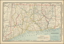
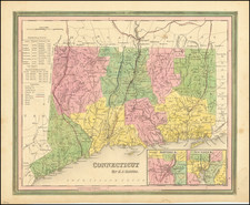
Description
A detailed and attractive map of Connecticut, with inset plans of Hartford and New Haven.
The map is hand colored by county, showing roads, canals, towns, steamship routes and other interesting details. Includes early railroads, Courthouses, Churches, Taverns, etc.
A chart shows the County populations and other details.
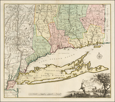
![[ Early Handwritten Annotations ] Connecticut From the best Authorities](https://storage.googleapis.com/raremaps/img/small/100909.jpg)