|
||

|

|
|

|
Fine Large Format Map of Cairo Showing Islamic Monuments – (Kharitat al-Qahira tubayyinu al-athaar al-Islamiyya)
Rare map of Cairo published in 1948 and made by the Survey Department.
This map focuses on the eras of urban and religious development in Cairo, revealing which Islamic monuments were constructed in which era throughout Egyptian history.
With Roda Island shown in the bottom left corner of the second sheet, the map shows the expanse of Cairo east of the Nile. The city’s sprawl is colored in dark yellow, with brighter colors marking specific buildings. These are Islamic monuments built at different times in Cairo’s history, as explained below.
All of the text and labels are written in English. At the bottom right corner of the second sheet, there is a green insignia with the number 401 inside of it. There is a graphic scale bar at the bottom of the second sheet and a legend to its left. Each color indicated on the legend represents a different era of Islamic monuments. It translates to the following (from top to bottom):
Brown – The Two States of Abbasi and Touloni (212-292 lunar / 827-904 Christ)
Red - The Fatmi Era (358-567 lunar / 969-1171 Christ)
Green - The Ayubi Era (567-648 lunar / 1171-1282 Christ)
Orange - Mamluks Maritime Era (648-784 lunar / 1282-1382 Christ)
Blue - Mamluks Circassian Era (784-923 lunar / 1382-1517 Christ)
Purple - Turkish and Muhammed Ali Era (923-1265 lunar / 1517-1848 Christ)
Gray - The Modern Era (1265-1364 lunar / 1848-1945 Christ)
Islamic Cities
Islamic communities have been urban in nature since the time of the Prophet Muhammad (570-632 CE). Most of them include a similar structure which includes suqs (spontaneous market developments), qaysariyas (planned market developments), and khans (trading establishments built into the cities). By the Middle Ages, most Islamic cities were divided by ethnic group. These districts were called haras. They provide a sense of community within a close-knitted neighborhood. While Islamic cities share many similarities in structure, Cairo is unique in its specific appearance as it continued to be reshaped through its centuries of existence.
Early Development in Egypt
Much of the development in Egypt has been situated around the Nile, which runs through the sheets of this map. It was easy to navigate both North and South (by sail). One of the world’s earliest urban settlements was Memphis, Egypt, situated at the junction of the river delta and the valley. It is to the southwest of Cairo today. From 3100 BCE, settlement flourished in this area.
The Romans arrived in 30 BCE, ruling essentially as a continuation of Greek rule in Alexandria (from 331 BCE). The Egyptian canal, known as Amnis Trojanis, from the Nile to the Red Sea was revived under the Roman rule of Trajan. By 380 CE, Christianity was recognized as the Roman Empire’s religion.
Islam came to the area in the seventh century as Roman rule was phased out. Though Alexandria was the Roman capital, the Muslim rulers preferred to settle east of the Nile, where they were not separated from Medina and the Arabian Peninsula by water. Islamic Cairo grew from the influence of successive dynasties and factions, particularly the Fatimids, who ruled the country for over 200 years.
The Making of Cairo
Historic Cairo is rich in Islamic monuments, both in quality and quantity. Between the seventh and nineteenth centuries, a multitude of dynasties constructed mosques, mausolea, madrasas (religious schools), palaces, houses, hammams (public baths) and fortresses that survive in varying states today.
The creators of this map divided Islamic development into distinct eras, which align generally with the eras outlined below. Each era is comprised of a different ruling dynasty who contributed distinct monuments to Cairo’s landscape.
Abbasids and Tulunids (750-935)
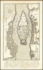
The Abbasid family ruled the region from Baghdad, violently ending the Umayyad dynasty. One member of Egypt’s new government, Ahmad ibn Tulun, separated himself and made great architectural progress during his rule of 870-905. Particularly notable are three monuments. The Aqueduct of Ibn Tulun, the Mosque of Ibn Tulun, and the Nilometer, Cairo’s oldest monument in its original form, built to measure the Nile’s annual flood. The Nilometer can be seen on this map at the southern tip of Roda Island, which lies on the left of this map. All development from this period is shown on the map in brown.
Fatimids (969-1171)
969 marked the transition to the two hundred-year Fatimid rule after they conquered Egypt as representatives of Shi’i Islam. They formed a new settlement for the purpose of housing the court and loyal troops of the Fatimid caliphs. This settlement became al-Qahira, later called “Cairo” by Italian traders. Medieval Cairo soon became the Mediterranean Empire’s central city.
The layout of Cairo was roughly square with straight roads, wide streets, and plentiful open spaces. The center of the city was dominated by the Royal Palace. Unfortunately, only a few buildings survive from this founding period: the al-Azhar mosque, the al-Hakim mosque, the al-Aqmar mosque, the Salih Tala’i mosque, the al-Guyushi mosque, the northern city gates, and the Southern Cemetery. These monuments can be seen in red in the central part of the first map sheet. Much of Cairo’s urban character can be attributed to the Fatmi Era.
In 1074, caliph al-Mustansir selected Badr al-Gamali as the new commander of the armies to suppress military revolt. The caliph did not expect al-Gamali to assume so much power. He took over all three branches of government in Cairo, and the power of the commander of the military grew, sacrificing some of the wazir and caliph’s power. Through his rule, the city was enlarged with walls reconstructed in stone.
The city changed dramatically as a result of a series of catastrophic events in the eleventh and twelfth centuries. The agricultural economy crashed when recurring floods launched a seven-year famine. A plague in 1063, an earthquake in 1138, and a devastating fire in 1168 catalyzed massive changes in the city’s urban fabric. As the town of al-Fustat was abandoned, al-Qahira was transformed into a diverse, yet disordered, city.
Ayyubids (1171-1250)
In order to help restore order in the capitol, Sunni leader Salah al-Din al-Ayyubi of Syria took over Cairo’s government, launching the Ayyubi Era and forcing out the Fatimid princes. His first goal was to convert Egypt from the Fatimid’s Shi’i sect of Islam back to Sunni. He also unified the city architecturally. Salah al-Din expanded educational architecture and added madresas to study Sunni Islamic law as well as khanqahs for Sufis.
During this era, the government began to construct the famous Citadel in 1176 as a defense, as well as new walls to enclose the city. The Citadel’s walls are shown in green in the upper right portion of the map’s second sheet. There are also other defenses shown in green throughout the map.
Cairo’s aqueduct was built during this period. There were also several significant tombs built during this time, including the tombs of Imam al-Shafi’i, the Abbasid Caliphs, the Madrasa-Mausoleum of al-Salih Nagm al-Din, and Shagarat al-Durr.
In total, there were seven Ayyubid sultans. Sultan al-Salih Ayyub, the sixth in the succession, began the importation of mamluks, or slave troops.
Mamluks (1250-1517)
The Mamluk Era strengthened Egypt’s army and military prowess. It can be broken down into Mamluk Maritime Era (1250-1382) involving the Bahri Mamluks, and the Mamluk Circassian Era (1382-1517) with the Burgi Mamluks. Mamluks were non-Muslim children that were captured or bought and trained to be soldiers in Egypt. After intense training and education in Islam, they could be freed.
During the Mamluk Maritime Era, Egypt’s wealth was sufficient to support a strong and well-trained army. The mamluks were able to fend off Mongol invasions that devastated neighboring countries. Sultan al-Nasir Muhammad (1293-1341) was able to elevate Cairo’s culture and architecture to its peak during this era, building 433 monuments.
Cairo expanded greatly during the thirteenth century, breaking out of the set Fatimid borders. A uniquely Egyptian type of building emerged from this period as well, known as Sabil-kuttabs. They were composed of public drinking water access on the bottom floor and schools to learn the Quran on second floor.
The Burgi Mamluks of the Mamluk Circassian Era were boarded in towers (burg) in Cairo’s Citadel. Burgi rule was even more violent and intense than the Bahri Mamluks, however, the Burgi suffered from a series of catastrophes and were eventually taken over by Ottoman Turks in 1517. There are 133 surviving monuments from this period (out of 270), including several mosques and tombs in the Northern Cemetery, shown in blue.
Ottoman Turk Era (1517-1798)
The Ottomans kept some of the Mamluk institutions, though much of the power dynamic in Cairo looked very different during this period. The city was led by a distant Ottoman governor and Ottoman militia. Cairo functioned as a vital trading site within the Ottoman Empire and an important link with the east. There are 216 listed monuments from this period, which, though numerous, are not as grand as from other eras. They are representative of the Ottoman style of architecture, but also show an interesting blend with the Mamluk style. They are shown in purple on the map.
Muhammad Ali Era (1805-1952)
When Muhammad Ali was appointed Egypt’s viceroy in 1805, he eliminated the final Mamluks, ending a 550-year institution in Egypt. He created luscious gardens out of lakes from the Mamluk and Ottoman periods. His mosque located in the Citadel continues to be one of Cairo’s most striking structures. He did much of his new construction in new areas of the city, like the eastern and western banks of the Nile. Any development from this era is also shown in purple.
Egypt’s Survey Department
The Survey Department in Egypt has changed focus and course over its many years in operation, but it has also involved comprehensive research and mapping of the country. Mr. G.W. Murray directed the Desert Survey from 1932-37 and the Topographical Survey of Egypt from 1937-47. The Survey has also been responsible for anthropological and archeological mapping and record keeping, like we see in this example of mapping Cairo’s historic Islamic monuments.
This important artifact reveals the mosaic of historic development that created modern Cairo. This map would appeal to those interested in Egypt, Islamic monuments, the history of Cairo, the history of Egypt’s ruling dynasties, and the architecture of the Middle East.
![Карта Восточной Части Африки [Map of the Eastern Part of Africa]](https://storage.googleapis.com/raremaps/img/small/66634.jpg)
![[ The Search for the Source of the Nile ] Nouvelle Carte du Bassin du Nil indiquant la commune origine de ce Fleuve avec les Rivieres du Zanguebar Dressee et Dediee A La Colonie Europeene D'Orient . . . 1858](https://storage.googleapis.com/raremaps/img/small/96196.jpg)