The item illustrated and described below is sold, but we
have another example in stock. To view the example which
is currently being offered for sale, click the
"View Details" button below.


|
||

|

|
|

|
Stock# 63641
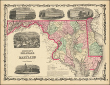
Description
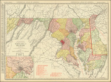
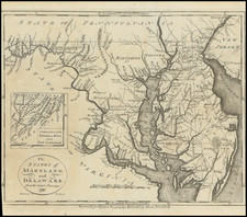
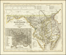
Detailed map of Maryland and Delaware, showing counties, towns, roads, rivers, lakes, islands, creeks, etc.
Inset of the continuation of the Potowmac River from Fort Cumberland. One of the earliest maps of Maryland and Delaware printed in the United States.
Reference
Wheat & Brun 519.
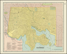
![[ Baltimore ] Map of the City and Suburbs of Baltimore Compiled from Actual Surveys 1853 . . .](https://storage.googleapis.com/raremaps/img/small/102136.jpg)